|
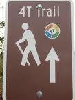
The 4T trail is well marked with signage.
Washington Park MAX station is the deepest in North America at 260 ft below ground. This is MAX's only below ground station.
|
Next
Streetcar
|
|
9
|
minutes |
|
23
|
minutes
|
|
37
|
minutes
|
|
51
|
minutes
|
|

971-404-2972
Code: 4509
|
NextBus uses Global Positioning System (GPS) tracking satellites to provide streetcar arrival information and real-time maps for Portland Streetcars passengers.

Transit Map
Click to Enlarge

The goal of TriMet's public art program is to promote increased transit usage and community pride by integrating temporary and permanent art works into TriMet's public transit system, thereby celebrating the contributions of public transportation and recognizing the cultural richness in the region.

An artist rendering of the new MAX trains for the Green Line. TriMet has ordered 21 new MAX trains from Siemens Transportation Systems for the I-205/Portland Mall MAX Light Rail Project scheduled to begin in 2009.
TransitTracker™ provides real-time bus and MAX arrivals online over the phone. The system tracks the actual location of your bus or train, so you know exactly when your ride is coming. Each stop has an unique "stop number" displayed on a sign like the photo above.
Get arrival times over the phone: Just dial 503-238-RIDE (7433) from any touch-tone phone. If you're using a web-enabled cell phone, you can access TransitTracker at wap.trimet.org. On a web-enabled PDA, log on to pda.trimet.org.

Portland has an extensive bicycle path system. Plus TriMet is now 100% bicycle friendly! All MAX and buses can accommodate bicycles. Check out the bike links.
Portland has the nation's highest rate of bicycling for a big city − 4.5 percent, according to the U.S. Census.
|
|
4T: Trail, Tram, Trolley, & Train
The 4T is a loop through roughly nine miles of the city's hilly west side by trail, tram, trolley and train. The 4T showcases a few of the city's attractions.
-
The first leg of the 4T began with a hike from the zoo to one of the city's highest peak, Council Crest and then continues to the tram at Oregon Health Sciences University (OHSU) for a total hike of about four miles. The trail is well-marked with signs.
-
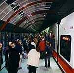
You board the tram at OHSU and down you go to the river into the South Waterfront neighborhood.
-
After exiting the tram walk over to the Portland streetcar stop and board the streetcar. The trolley followed the waterfront to Harrison Street and swings uphill through Portland State University before coming to a stop about 20 minutes later at Southwest 10th and Morrison.
-
A last leg of the 4T is aboard a MAX train bound for the zoo.
Plan for about a 3-hour excursion. The trail is free, and so is the tram ride from OHSU to the waterfront. A two-hour TriMet pass for the trolley and train portions of the route is $2, an all-day pass $4.75. Click here for a 2-page guide.
Urban Alternative to the 4T
Therese Bottomly, a writer for THE OREGONIAN, came up with an unofficial and more urban alternative to the 4T that will take you to some of the best viewpoints and a few of the city's most appealing attractions. It ends with a strenuous uphill walk, so it's best for tourists who enjoy a workout. Therese's hike was featured in the Community News section of THE OREGONIAN on July 3, 2010. Below is the description.
Hiking boots and a water bottle are recommended. You'll need some money for food, and it will cost about $20 for rides and admission to the Oregon Zoo for nonmembers.
The Starting Point
The start is Council Crest Park, long a favorite spot for Portlanders to bring out-of-towners for its stunning views.
At 1,073 feet, the park shows off Mount St. Helens to the north with its snow-cone shape. The behemoth 14,411-foot Mount Rainier, about 100 miles away, peeks over St. Helens' western shoulder. Mount Adams is to the northeast, and Mount Hood is due east.
Pick up the 4T Trail near the entrance to the park, where a 4T sign is posted. Exit the trail onto Southwest Talbot Road, go straight to Patton Road and turn right on Patton. No sidewalks here, so use caution.
Less than a tenth of a mile down Patton on the left, pick up the Marquam Trail into the woods. It's marked "To Wildwood Trail."
Hikers descend into a forest that seems hours from anywhere but is actually just under a mile from the congested Sunset Highway, where the trail ends on the south end of the Oregon Zoo overpass.
At the zoo, buy a train ticket but take a break first for a side trip to a few of the exhibits. The Cascade Canyon Trail keeps with the forest theme, taking visitors to the Black Bear Exhibit and Eagle Canyon.
Two Amur tigers and a leopard are close to the train station, so they are easy to catch as well. Predators of the Serengeti, with three lions on exhibit, is a ways down the path past the concert lawn.
The 64-acre zoo, a leader in species preservation, traces back to when a Portland pharmacist named Richard Knight obtained two bears -- a grizzly called Grace and a brown bear aptly named Brownie. According to The Oregonian's archives, sailors would bring animals to Knight from overseas. By 1887, the collection had gotten out of hand, so he donated it to the city.
The train, an always-popular feature of the zoo, started operation in 1958 with the Zooliner, still one of the primary trains in use.
Depending on the time of day and year, the line for the train can be long. Be patient, though -- it moves fairly quickly. The trip to Washington Park takes about 15 minutes.
The Original Rose Garden
The International Rose Test Garden is stunning when in full bloom, as it is now. The gardens have more than 8,000 bushes of more than 600 varieties of roses. One shrub rose comes from a cutting of a 1,000-year-old plant next to a German cathedral.
The Rose Garden is part of Washington Park, which the city purchased in 1871 (over the objections of some residents who couldn't see anything more than a cougar-infested forest) for $32,624. On parkland leased from the city, the Portland Japanese Garden now stands on part of the former city zoo -- with the teahouse where the monkey house used to be.
Downhill from the roses is the Oregon Holocaust Memorial, where stones evoke the railroad tracks that took victims to concentration camps. Scattered around the grounds are replicas of items left behind -- a teddy bear, a shoe, a violin among them.
Off to Northwest 23rd
East of the memorial, a trail leads from the intersection of Washington Way and Sterns Drive downhill to West Burnside Street, which slices Portland into north and south. Across Burnside about a block north is Northwest 23rd Avenue, a bustling shopping and eating district.
On a sunny day, the sidewalks will be crammed with diners and visitors browsing boutiques.
Kornblatt's New York Style Deli (628 N.W. 23rd Ave.) serves up pastrami sandwiches and bagels with schmear, along with beer, wine and cocktails. Rose's Restaurant and Bakery (838 N.W. 23rd Ave.), a few blocks north, is known for its Reubens and extravagant desserts. Thirsty travelers can grab a beer there or stop at the Rams Head (23rd and Hoyt Street), which offers the standard McMenamin's pub fare and 11 beers on tap.
For an atmosphere closer to the old, not-so-trendy neighborhood, head for the Nob Hill Bar & Grill (937 N.W. 23rd Ave.) " -- known as "Nobby's" by the regulars -- for a burger.
Next up, the Streetcar
The Portland Streetcar picks up eastbound passengers one block off 23rd at 22nd Avenue and Northwest Lovejoy Street. The route heads east and south through the Pearl District and to Powell's City of Books.
At the Southwest 11th Avenue and Couch Street stop, Powell's takes up an entire block across the street. It boasts more than a million new and used books.
Visitors can spend hours exploring its nine color-coded rooms. Powell's says about 3,000 people come in and buy something each day, with another 3,000 who come in just to browse.
Jump back on the streetcar from the same stop (the ticket is valid on the streetcar all day) and head through downtown toward South Waterfront.
As the streetcar dips down to the riverfront area, passengers will see the Portland Aerial Tram and its signature metallic tower holding up the cables. The stop at Southwest Gibbs Street is across Moody Avenue from the terminus, where riders can buy a $4 ticket for the ride uphill in one of the two cars, named Jean and Walt.
Now, the Hiking Boots
The tram drops passengers at Oregon Health & Science University's Kohler Pavilion, 1,100 yards up from where the trip started.
Head uphill on Southwest Sam Jackson Park Road, following the road as becomes Southwest Gibbs and then Marquam Hill Road.
Baack, the trails advocate, said the city needs to add sidewalks on portions of Marquam Hill Road to make it safer for pedestrians. Caution is advised as hikers climb up about a half-mile to Southwest Fairmount Boulevard.
Turn right on Fairmount for another six-tenths of a mile to the Marquam Trail heading back uphill to Council Crest and -- mercifully -- your car.
Stops on an Urban Trail
Information is for summer 2010. Check for fall and winter hours and closures.
Council Crest
Where: Southwest Council Crest Drive, off Southwest Greenway Avenue
Hours: Open 5 a.m. to midnight; gate closes to motor vehicles at 9 p.m.
Online: portlandonline.com/parks
Notes: Although it is oft-advertised as the highest point in Portland, it's not. Metro's data puts the highest point inside city limits as just off Northwest Skyline Drive, near Skyline Memorial Gardens, at 1,180.7 feet.
Oregon Zoo
Where: 4001 S.W. Canyon Road
Hours: 8 a.m. to 6 p.m. (summer hours until Sept. 15)
Cost: $10.50 ages 12-64, $9 ages 65 and older, $7.50 ages 3-11 and free for ages 2 and younger
Online: oregonzoo.org
Notes: Walkers can avoid the entry lines and the $2 parking surcharge by purchasing e-tickets at home on the zoo's website. You can't buy a train ticket online, so head to the station for that.
Washington Park and Zoo Railway
Where: Inside the zoo, down the main path and to the right
Hours: 10:30 a.m. to 5 p.m. through Labor Day (the steam train will run Labor Day weekend)
Cost: $5 in addition to zoo admission. $4.50 for zoo members; 2 and younger free.
Online: oregonzoo.org/AboutZoo/train.htm
Notes: Trains are covered but windows are open-air. Don't expect to lean out for photos, though. Riders are warned to keep hands and arms inside.
Washington Park International Rose Test Gardens
Where: 400 S.W. Kingston Ave.
Hours: 7:30 a.m. to 9 p.m.
Online: portlandonline.com/parks
Notes: Free tours through Sept. 21. Check times and days at the Rose Garden Store or the Portland Parks website.
Oregon Holocaust Memorial
Where: Inside Washington Park near Southwest Wright Avenue
Hours: 5 a.m. to 10 p.m.
Online: ohrconline.org
Notes: Before your visit, you can take a virtual tour online created for the Oregon Holocaust Resource Center.
Portland Streetcar
Where: Loops from Nob Hill through the Pearl District, downtown and Portland State University, to South Waterfront and back
Hours: 5:30 a.m. to 11:30 p.m. Mondays-Thursdays; 5:30 a.m. to 11:45 p.m. Fridays; 7:15 a.m. to 11:45 p.m. Saturdays; 7:15 a.m. to 10:30 p.m. Sundays. Check online for holiday schedules.
Cost: $2 ages 18-64, 95 cents ages 65 and older, $1.50 ages 7-17, free for ages 6 and younger
Online: portlandstreetcar.org
Notes: During daytime, service is every 13-15 minutes. Fareboxes onboard accept coins, including $1 coins, and $1 and $5 dollar bills, or use your TriMet pass.
Powell's City of Books
Where: 1005 W. Burnside St.
Hours: 9 a.m. to 11 p.m. daily (closes at 9 p.m. July 4)
Online: powells.com
Notes: The store is so big it actually has a "master of tours" and offers group tours for 10 or more, reserved at least two weeks in advance. Call 503-228-4651, ext. 1436, and ask for Bruce Burkhardt for details.
Portland Aerial Tram
Where: Eastern terminus at 3303 S.W. Bond Ave., western terminus at 808 S.W. Campus Drive
Hours: 5:30 a.m. to 9:30 p.m. weekdays; 9 a.m. to 5 p.m. Saturdays; 1 to 5 p.m. Sundays. Summer hours good through Sept. 19. Closed July 4-5 and Sept. 6.
Cost: $4 or show your TriMet pass (or Portland Streetcar annual pass). Ride downhill for free.
Online: portlandtram.org
Notes: The ticket machines at the South Waterfront tram terminal accept credit or debit cards and quarters, not bills or other coins.
|