|
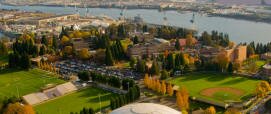 The neighborhood is home to the University of Portland, a private catholic college. The school is noted for its powerful women's soccer team that are always ranked among the top teams in the nation. Although the campus, sitting on the south side of the neighborhood overlooking the river, is attractive and serene the area is most definitely not a "college neighborhood." Where are the pubs, coffee shops, and other student related businesses? The problem is that there's no town center where people can congregate and walk. Instead you have to drive from establishment to establishment. The neighborhood is home to the University of Portland, a private catholic college. The school is noted for its powerful women's soccer team that are always ranked among the top teams in the nation. Although the campus, sitting on the south side of the neighborhood overlooking the river, is attractive and serene the area is most definitely not a "college neighborhood." Where are the pubs, coffee shops, and other student related businesses? The problem is that there's no town center where people can congregate and walk. Instead you have to drive from establishment to establishment.
The northern border of University Park is the high traffic (mainly trucks) Lombard Street. Lombard is the the main road through North Portland between I-5 and the St. Johns neighborhood. Along the road you will see paycheck cashing outlets and bars along with fast food restaurants with a few other businesses. The Java Bean, 4823 N. Lombard Street, is the place to stop for a latte, pastry and a chat.
University Park has seen an influx of new residents to the area as the housing prices are low enough to attract first-time buyers who are ambitious about remodeling their homes. So University Park now has some areas with improved homes and neighborhoods and some still in transition. Most homes were built after WWII (no defining style). University Park has a handful of classic homes and those are mainly Queen Ann Victorians and Colonials. Most of the homes are on small lots. Surprisingly, there are no apartment houses as the University of Portland students all live on campus or in homes.
History
Three groups of interesting street names in north Portland are survivors of an attempt by the Methodist Church to establish a university here. It was located on Waud's Bluff, where the University of Portland is today. The Methodists' institution, called Portland University, opened in 1891. Because of financial difficulties, it lasted for less than a decade. Subsequently, the campus and buildings were purchased by the Roman Catholic Archdiocese, and the facilities re-opened in 1901 as Columbia University, with a faculty of priests from the Order of Holy Cross. In 1935, it was renamed University of Portland.
Surrounding the original Methodists' University, and conceived as its financial base, was a large real estate development. The names which the Methodists assigned to the streets in their "University Park" subdivision were enduring. Nineteen of those street names are compliments to American colleges and universities (Amherst, Berkeley, Harvard, Oberlin, Stanford, Yale, etc.). Another 18 streets were named to honor educators, theologians, and authors who were prominent in the nineteenth century (Dana, Hurst, Kimball, Olin, Wayland, Winchell, etc.). Fourteen names commemorate Methodist bishops, ministers, prominent laymen, and places important in Methodist history. The 51 streets are within about half a mile of the University of Portland.
The Methodists founded two other colleges in Oregon: Willamette University and Corvallis College (now Oregon State University).
The University Park neighborhood Web site has more information about the history of the area.
Sun for Everyone
When the Methodists accumulated 600 acres around the present-day University of Portland in early 1891, the trustees set aside 71 acres for the university campus. The rest of the tract − about 500 city blocks − was platted into residential building lots. It was in making the plat maps for these subdivisions that the Methodists had the pleasure of selecting the street names listed above. An interesting feature in part of the development was this: the streets were laid out running northeast-to-southwest and northwest-to-southeast, so that, if a house were placed squarely on its lot, every side of the house would, at some time during the day, have the sun upon it.
Origin of Name
University Park is so named because the neighborhood surrounds the University of Portland. It actually was named for the Methodist college called Portland University.
1University Park Home Prices
-
Number of homes sold in University Park in 2010: 64. Distressed properties sales were 19%.
-
Median price for homes sold in University Park: $256,500 in 2010; $262,300 in 2009; $280,500 in 2008.
-
1-year median sales price change in 2010 from 2008 in University Park: -2%.
-
5-year average sales price change in University Park: -5%.
-
Metro area median home prices: $239,900 in 2010; $247,000 in 2009; $278,000 in 2008; $290,000 in 2007.
-
Metro area average home prices: $282,100 in 2010; $289,900 in 2009; $330,300 in 2008; $342,000 in 2007
Please be aware that the above figures are subject to error and are intended as guidelines only. View University Park homes currently for sale by clicking here.
Parks and Health Clubs
 One of the crown jewels of the Portland Park system is the 35-acre Columbia Park located in the both the University Park and Portsmouth neighborhoods. The park includes baseball, softball, and soccer fields, two lighted tennis courts, volleyball court, horseshoe pit, swimming indoor pool, wading pool, playground, picnic shelter, and tables, electricity, restrooms, trails, and parking lot. This park has been "adopted" by the Friends of Columbia Park. For information about renting Columbia Cottage, go to www.focp.org. One of the crown jewels of the Portland Park system is the 35-acre Columbia Park located in the both the University Park and Portsmouth neighborhoods. The park includes baseball, softball, and soccer fields, two lighted tennis courts, volleyball court, horseshoe pit, swimming indoor pool, wading pool, playground, picnic shelter, and tables, electricity, restrooms, trails, and parking lot. This park has been "adopted" by the Friends of Columbia Park. For information about renting Columbia Cottage, go to www.focp.org.
Although the city has a placeholder on its Web site about a park called Harbor View City Park, it is an old industrial site along the river full of trash and perhaps some day they will either make a park out of it or it will be developed.
The neighborhood has two other parks:
-
McKenna Park The 4.5 acre park includes a basketball court, paths, picnic tables, playground, soccer field, and softball field.
-
Portsmouth Park The four acre park includes a playground, soccer field, and softball field.
Walking in the University Park Neighborhood
Walk Score ranks 2,508 neighborhoods in the largest 40 U.S. cities to help you find a walkable place to live. 45% of Portland residents have a Walk Score of 70 or above. 83% have a Walk Score of at least 50—and 17% live in Car-Dependent neighborhoods. Please note that we use an address in the center of each neighborhood to determine the Walk Score. Scores will vary in a neighborhood depending upon the address.
Transit Score provides a 0-100 rating indicating how well an address is served by public transportation. Ratings range from "Rider's Paradises" to areas with limited or no nearby public transportation.
More About University Park
University Park Neighborhood Association Web Site University Park.
Neighborhood Location The west boundary is along the Willamette River about 3-4 miles north of downtown.
1Drive Time to Downtown 18-20 minutes.
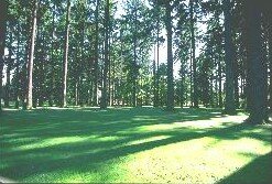
Topography University Park seats on a bluff overlooking Swan Island and Columbia River. The topography is flat with mature trees on most properties.
Sidewalks and Streets The street pattern is a grid layout. The neighborhood has sidewalks for walking.
Livability Study 86.8% of University Park residents rated their neighborhood "good" or "very good." See Livability Study.
Public Transportation The schedule can be found at TriMet Web site for the three neighborhood bus routes. The Interstate MAX light rail line is about a mile from the heart of University Park to a stop (Portland Boulevard). Transit Score provides a 0-100 rating indicating how well an address is served by public transportation. Ratings range from "Rider's Paradises" to areas with limited or no nearby public transportation.
22000 Demographics Population: 5,250 persons. Area: 766 acres. Average population density: 6 persons per acre. Number of households: 1,692. Median household income: $61,228. Home owners: 73%. Renters: 27%. Diversity: 16% non-Caucasian.
3Crime Stats for 2010 13 violent crimes. Total crimes per 1,000 residents was 46.
4Shopping and Services Number of supermarkets: 1. Number of health clubs: 0. Number of coffee shops: 0. North Lombard Street is the main street and it has a bit of everything from fast food outlets to a couple of coffee shops and taverns. A Fred Meyer supermarket is located at North Interstate Avenue and North Lombard. Portland based New Seasons Market is located on N. Interstate and N. Portland Boulevard. Traveling west on Lombard, you will not be impressed with the quality of the commercial area. East is a different story as the MAX light rail has changed the character of this commercial area along N. Interstate Avenue − you will now find banks, fast food outlets, restaurants, coffee shops, etc.
Eating Out North Lombard Street is the main street and it has a bit of everything from fast food outlets to a couple of coffee shops and taverns. There are a few restaurants along Lombard but we cannot attest to the quality of the food or service as we have never ventured into one of them. Your best bet for a meal is to try some of the restaurants along N. Interstate such as Fire on the Mountain (buffalo wings).
Public Library The closest branch library of the Multnomah County Library system is the St. Johns at 7510 N. Charleston Avenue.
Who Lives in University Park University staff and students, professionals who commute to downtown Portland, and industrial workers because of the close proximity to the Northwest Industrial area. The median age is 31.
What They Drive in University Park Modest vehicles to include a few SUVs and pickups.
Biking Quality is fair. University Park has five miles of bike lanes. Bicycle Trip Planner will map a route for you and − just provide a starting point address and your destination address.
Schools Northeast: Elementary school: Astor Elementary. Middle school: Portsmouth. High school:- Roosevelt High School.
School Report Cards Elementary schools: O/S Middle schools: NA. High school: O/S. Click here for report card details.
Map of the University Park Neighborhood
View Larger Map
Fly to the University Park Neighborhood via Google Earth
___________________________________
1Real Estate Values Data on real estate values provided by RMLStm. Distressed properties refer to the percentage of total homes sold that were short sales and bank-owned properties.
2Drive Time to Downtown Estimated commuting time obtained from Yahoo Maps and Google Maps. Drive time was calculated from a central intersection in each neighborhood to Pioneer Courthouse Square during the morning peak commute time.
3Demographics Data Numbers were obtained from Census 2000 and www.portlandmaps.com.
4Crime Statistics Numbers on crime represent total crimes for 2010 and were obtained from Portland Police Bureau. Violent crimes are defined as murder, rape, robbery, and aggravated assault. Crimes per 1,000 are based on reported incidents of violent crime, as well as burglary, larceny, and motor vehicle theft.
5Shopping and Services Numbers were determined from local directory listings and county/municipal library systems.
6Biking Quality rating based on the 2007 Cycle Zone Analysis conducted by the City of Portland Office of Transportation. The six-tier ratings have been reduced to three levels: High, Fair, and Low.
7School Report Card Grades Schools ratings from the Oregon Department of Education 2009-2010 performance assessment. "O" = Outstanding; "S" = Satisfactory; "I" = In Need of Improvement; NR = Not Rated.
|