|
Built along a ridge northwest of downtown and only 10-15 minutes from the attractions of the Northwest District, it combines rolling green pastures and views east and west. The Forest Park neighborhood is named because of its proximity to the 5,000 plus acre Forest Park, the southern portion of which lies within the neighborhood boundaries and the rest of which is adjacent. Most of the neighborhood lies within unincorporated Multnomah County, though it does include some areas within Portland city limits.
If you desire the "look and feel" of a suburban community but want to be close to downtown, examine the Forest Park neighborhood closely.
The 600 acre development named Forest Heights is located to the southwest of the Forest Park neighborhood - it is in Washington County. It is commonly referred to as the "Intel Country Club" because so many of the Intel engineers who work in Hillsboro live in Forest Heights.
Forest Park is a great place to bring up a family as some of the best schools in Oregon are located in the neighborhood. For example, the Forest Park Elementary has been rated "exceptional" since 2004. See the latest State of Oregon Department of Education Report Cards.
Origin of the Name Forest Park
The neighborhood is located adjacent to the 5,000 plus acre City of Portland Forest Park.
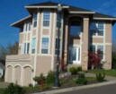
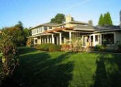
Forest Park Home Styles
Diversity in homes styles and sizes are the attraction. Townhomes under 2,000 square foot to 3,000 plus square foot detached single-family homes are found in Forest Park. Most have been constructed in the last ten years and the area is still being developed. Many of the homes have views of the coast range to the West and are within walking distance of the 5,127 acre Forest Park which is on the east side of the elongated neighborhood (about 5 miles in length).
1Forest Park Home Prices
-
Number of homes sold in Forest Park in 2010: 17. Distressed properties sales were 24%.
-
Median price for homes sold in Forest Park: $600,000 in 2010; $610,000 in 2009; $655,000 in 2008; $762,500 in 2007.
-
1-year median sales price change in 2010 from 2009 in Forest Park: -2%.
-
5-year median sales price change in Forest Park: -29%.
-
Metro area median home prices: $239,900 in 2010; $247,000 in 2009; $278,000 in 2008; $290,000 in 2007.
-
Metro area average home prices: $282,100 in 2010; $289,900 in 2009; $330,300 in 2008; $342,000 in 2007.
Please be aware that the above figures are subject to error and are intended as guidelines only. View Forest Park homes currently for sale by clicking here.
Walking in Forest Park: 70 Miles of Trails
 Portland's Forest Park is the 14th largest city park in the United States and some authorities say it is the largest wooded park in the country. Covering 5,000 plus acres, it provides a hushed and peaceful environment of a varied and evolving forest ecosystem. Overlooking the Willamette River, the Park stretches for nearly eight miles along the northeast slope of the Tualatin Mountains between NW Skyline Boulevard and NW St. Helens Road (Hwy. 30). Portland's Forest Park is the 14th largest city park in the United States and some authorities say it is the largest wooded park in the country. Covering 5,000 plus acres, it provides a hushed and peaceful environment of a varied and evolving forest ecosystem. Overlooking the Willamette River, the Park stretches for nearly eight miles along the northeast slope of the Tualatin Mountains between NW Skyline Boulevard and NW St. Helens Road (Hwy. 30).
Forest Park is home to over 100 species of mammals: more than 100 kinds of birds have been seen in the Park. In the spring, hillsides sparkle with trilliums amidst the sword ferns; hundreds of other kinds of flowers and shrubs bloom during the year.
The Park offers enjoyment to hikers, bicyclists, runners, and others who just enjoy being outdoors in a forest atmosphere. The 30+ mile long Wildwood Trail (a National Recreational Trail) traverses the Park from the Vietnam Veterans' Memorial in Hoyt Arboretum to Newberry Road. A total of more than 70 miles of interconnecting trails and lanes provide opportunities for circle hikes of varying length.
Forest Park has 4,794 acres of park land and open spaces according to Metro and the Portland Department of Parks and Recreation.
A Father and His Son Hike Forest Park
This video is a father and son hiking Forest Park. Miles of trails serve bikers, hikers, and casual strollers. One of the most popular hikes is the portion of the Leif Erikson trail that begins at the end of NW Thurman Street. A wide, leafy fire trail with a gradual uphill grade, you can bike or walk the trail. It's also a popular place for runners.
See the Friends of Forest Park Web site for more information. Forest Park is on Facebook.
Walk Score ranks 2,508 neighborhoods in the largest 40 U.S. cities to help you find a walkable place to live. Forest Park is the #56 most walkable neighborhood in Portland. This neighborhood is a Car-Dependent neighborhood with an average Walk Score of 38. Below is a Walk Score for an address in the center of the neighborhood.
More About Forest Park
-
Neighborhood Association Web Site The neighborhood does not have a Web site.
-
Location of Neighborhood West Burnside (turns into Barnes Road after leaving the downtown area) to NW Skyline Road.
-
2Drive Time to Downtown 18-19 minutes.
-
Topography Moderate to very hilly. It is a heavily wooded area and many homes have views of the Coastal Mountain Range.
-
Streets and Sidewalks Void of sidewalks except along Miller Road in Forest Heights. The streets leading to the developments can be winding and narrow.
-
Livability Study 96% of Forest Park Heights residents rated their neighborhood "good" or "very good." See Livability Study.
-
Public Transportation Forest Park has two two bus routes - visit the TriMet Web site. No MAX light rail or streetcar lines in Forest Park. Transit Score provides a 0-100 rating indicating how well an address is served by public transportation. Ratings range from "Rider's Paradises" to areas with limited or no nearby public transportation.
-
32000 Demographics Population: 2,360 people. Area (acres): 6,996. Average population density: 3 persons per acre. Number of households: 859. Homeowners versus renters: 91 percent owners. Median household income: $96,747. Diversity: 16% non-Caucasian.
-
4Crime Stats for 2010 Three violent crimes. Total crimes per 1,000 people was 32. For the latest crime statistics for the Forest Park neighborhood, click here.
-
Sex Offenders Click here for the State of Oregon Sex Offender Inquiry System. After agreeing to the "Conditions of Use Statement" you will be redirected to a "Enter Search Criteria" page. Insert a zip code in the "Zip" field and click on the "Query" button. Forest Park zip code(s): 97210, 97229, 97231.
-
5Shopping and Services These neighborhood is void of any retail establishments but it is a short drive to a small mall (corner of SW Barnes Road and NW Miller Road) with a QFC supermarket, Starbucks, cleaners, pizza, vet, etc. Residents are about 10-15 minutes from the Northwest District as well as a larger mall just off NW Cornell Road. In Forest Heights (southwest of the neighborhood), the area's first commercial site is been developed at NW Miller Road and NW Mill Ridge. It has a grocer and Starbucks.
-
Eating Out The Skyline Restaurant is located at 1313 NW Skyline Boulevard and it attracts locals and outsiders. The Skyline is reasonably price but don't expect gourmet food. For an evening meal, the closest food source is the Outback Steakhouse at 11146 SW Barnes Road.
-
Public Library You have to go downtown to the Multnomah County Central Library or to the Northwest District branch located at 2300 NW Thurman Street.
-
Who Lives in Forest Park Young professionals who usually are married. Only 14.4 percent of the households have one person living in them. The median age is 43.
-
Cars in the Neighborhood Safe family cars. The second car is usually a SUV or a sporty car for Dad to drive to work.
-
6Biking Quality is low. Forest Park has 34 miles of bike lanes.
-
Schools Elementary school: Forest Park. Middle school: East-West Sylvan. High school: Lincoln High School.
-
7School Report Card Grades Elementary schools: O. Middle schools: O. High schools: O/S. Click here for report card details.
Map of Forest Park Neighborhood
View Larger Map
Fly to the Forest Park Neighborhood via Google Earth
________________________________________________
1Real Estate Values Data on real estate values provided by RMLStm. Distressed properties refer to the percentage of total homes sold that were short sales and bank-owned properties.
2Drive Time to Downtown Estimated commuting time obtained from Yahoo Maps and Google Maps. Drive time was calculated from a central intersection in each neighborhood to Pioneer Courthouse Square during the morning peak commute time.
3Demographics Data Numbers were obtained from Census 2000 and www.portlandmaps.com.
4Crime Statistics Numbers on crime represent total crimes for 2010 and were obtained from Portland Police Bureau. Violent crimes are defined as murder, rape, robbery, and aggravated assault. Crimes per 1,000 are based on reported incidents of violent crime, as well as burglary, larceny, and motor vehicle theft.
5Shopping and Services Numbers were determined from local directory listings and county/municipal library systems.
6Biking Quality rating based on the 2007 Cycle Zone Analysis conducted by the City of Portland Office of Transportation. The six-tier ratings have been reduced to three levels: High, Fair, and Low.
7School Report Card Grades Schools ratings from the Oregon Department of Education 2009-2010 performance assessment. "O" = Outstanding; "S" = Satisfactory; "I" = In Need of Improvement; NR = Not Rated.
|