|
 Laurelhurst is a close-in residential area of 427 acres containing in 1,817 households with a total of 4,549 people (2000 census). 86% of the Laurelhurst residents live in their own homes. It's about a 7-10 minute drive to downtown Portland once you turn onto East Burnside. Laurelhurst is a close-in residential area of 427 acres containing in 1,817 households with a total of 4,549 people (2000 census). 86% of the Laurelhurst residents live in their own homes. It's about a 7-10 minute drive to downtown Portland once you turn onto East Burnside.
You know that Laurelhurst residents care about their community when see the committees for the Neighborhood Association: Land Use, Transportation, Traffic, Trees, Safety, Garage Sale, Friends of the Laurelhurst Park, Bike, Clean-up, Environment, and Community Safety.
If you looking to nurture your young ones and instill in them caring values, find a home in Laurelhurst. Members of the neighborhood's Laurelhurst Kids Club not only have the names, phone numbers and addresses of other parents with children the same age in the area, but also have access to weekly play groups, vetted babysitters, critiques of nearby preschools and e-mail alerts with key information, such as a stroller recall or free swim lessons. All parents have to do is log on to the Kids Club at the Laurelhurst neighborhood association Web site.
History of Laurelhurst
In 1850 congress passed the Donation Land Act, which encouraged individuals to head out west and claim large tracts of land. Those arriving on December 1st, through to the time when the Act expired (December 1, 1855), were eligible for 320 acres if married, and 160 acres for unmarried males. Note that women could not claim land on their own, but if they claimed land as part of a married couple, their name was put on the deed, marking one of the first times in the history of the US when women could directly own property. To gain the deed to the land, a settler would have to live on, and maintain, the land for 4 years.
The area that would become Laurelhurst is comprised of two claims under the Donation Land Act. The first claim (claim #1008) was made by Elijah B. Davidson and his wife Saloma. The second claim (claim #1027) was settled by Terence and Mary Quinn.
In 1869, William S. Ladd began buying up the land that would eventually become Laurelhurst. It wasn't his plan to turn the land into a place for a rich community to be formed...at least not a community of people. One portion of the land (320 acres) came from the purchase of Thomas Frazer's Hazelwood Farm in 1869. After the 1869 purchase, other purchases were subsequently made in 1873 and 1876. Ladd named his land "Hazelfern," the name of one of the streets in the area. Here Ladd developed one of the most prestigious stock farms in the West. His purebred Jersey cattle probably laid the foundation for Oregon's future livestock industry.
Ladd died in 1893, likely marking the transition of the property from farming to residential use; though, like his son, William S. Ladd would have likely found both pressure from the surrounding neighborhoods (for such things as roads through the property) and skyrocketing land prices.
Origin of the Name Laurelhurst
The Laurelhurst Company purchased most of the property in 1909 except for 31 acres that was sold to the City of Portland for the Laurelhurst park. The company christened the new subdivision "Laurelhurst," using the same name they had already employed for a successful "Laurelhurst" residential area they developed in Seattle. "Hurst" is an old Anglo-Saxon word meaning "a wood, grove, or copse," and "laurel" was chosen because of the shrubs growing in the Seattle development.
Laurelhurst Theater
 The Laurelhurst Theater became part of Portland's cultural and architectural history when it was built in 1923, one of the first art deco style buildings of the period. The Laurelhurst Theater became part of Portland's cultural and architectural history when it was built in 1923, one of the first art deco style buildings of the period.
Like every theater in the country, what was once a successful family theater lost out to the multiplexes of the late eighties. In 2001, months of renovation brought the theater back to stand again as a proud icon to Portland's history and future. The theater's four screens bring the best of modern cinema, independent art and classic film to Portland's movie lovers at remarkably reasonable prices. Starred attractions are only $3 while general films are $2. It's independently owned and operated without commercials and previews are limited to five minutes.
Laurelhurst Home Styles
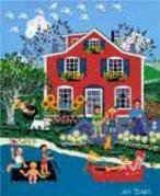
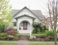
Bungalow, English, and Tudors are common.
1Laurelhurst Home Prices
-
Number of homes sold in Laurelhurst in 2010: 63. Distressed properties sales were 6%.
-
Median price for homes sold in Laurelhurst: $445,000 in 2010; $460,000 in 2009; $491,000 in 2008; $514,000 in 2007.
-
1-year median sales price change in 2010 from 2009 in Laurelhurst: -3%.
-
5-year median sales price change in Laurelhurst: -10%.
-
Metro area median home prices: $239,900 in 2010; $247,000 in 2009; $278,000 in 2008; $290,000 in 2007.
-
Metro area average home prices: $282,100 in 2010; $289,900 in 2009; $330,300 in 2008; $342,000 in 2007.
Please be aware that the above figures are subject to error and are intended as guidelines only. View Laurelhurst homes currently for sale by clicking here.
Parks in the Neighborhood
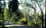 Laurelhurst Park is a spring-fed pond on the property had always been a favorite watering-hole for cattle, as well as a favorite swimming hole for both children and adults. In 1911, seeing the potential for a park as part of the Olmsted's plan, the City of Portland bought 30-31 of the acres, including the pond. Workers were hired to deepen the pond into a 3-acre lake. Also developed was a "play park" between Oak and Stark Streets. The boys were to play on the south side, the girls were to play on the north side, and general games were to be held in the eastern block. Laurelhurst Park is a spring-fed pond on the property had always been a favorite watering-hole for cattle, as well as a favorite swimming hole for both children and adults. In 1911, seeing the potential for a park as part of the Olmsted's plan, the City of Portland bought 30-31 of the acres, including the pond. Workers were hired to deepen the pond into a 3-acre lake. Also developed was a "play park" between Oak and Stark Streets. The boys were to play on the south side, the girls were to play on the north side, and general games were to be held in the eastern block.
In the park's early years, it was patrolled by a white swan named General Pershing (for his militant attitude). He forbade anyone to approach the edge of the lakeshore. In later years a black-beaked, black-toed swan, named "Big Boy," was lake marshal. A man known only as Mr. Martinson fed Big Boy every day for 15 years. Mr. Martinson taught Big Boy to nod his head and honk "Hello!"
In the Laurelhurst park's early years, it was patrolled by a white swan named General Pershing (for his militant attitude). He forbade anyone to approach the edge of the lakeshore.
The park includes soccer field, basketball and volleyball courts, two lighted tennis courts and practice board, horseshoe pit, wading pool, playground, picnic tables, electricity, restrooms, and paths.
In February 2001, Laurelhurst Park was named to the National Register of Historic Places, the first city park ever listed on the national register.
Laurelhurst has 33 acres of park land and open spaces according to Metro and the Portland Department of Parks and Recreation.
Walking in Laurelhurst
 This 3.5-mile walk loops through Laurelhurst. The walk passes wooded Laurelhurst Park en route to the Sunnyside neighborhood with its many Queen Anne homes and lively commercial scene on SE Belmont Street. Joan of Arc memorializes the fallen soldiers of World War 1 in Coe Circle at NE 39th and NE Glisan. In honor of the American Doughboy, soldiers closely allied with the French in World War I, Dr. Henry Waldo Coe donated the statue (Joan of Arc, Maid of Orleans 1412-1431). She sits atop her horse at the intersection of NE 39 Street and Glisan (now called Coe Circle) in the Laurelhurst neighborhood. The statue was created by Emmanuel Fremiet in 1924.You'll see her on the walking tour. Click here to download the guide. This 3.5-mile walk loops through Laurelhurst. The walk passes wooded Laurelhurst Park en route to the Sunnyside neighborhood with its many Queen Anne homes and lively commercial scene on SE Belmont Street. Joan of Arc memorializes the fallen soldiers of World War 1 in Coe Circle at NE 39th and NE Glisan. In honor of the American Doughboy, soldiers closely allied with the French in World War I, Dr. Henry Waldo Coe donated the statue (Joan of Arc, Maid of Orleans 1412-1431). She sits atop her horse at the intersection of NE 39 Street and Glisan (now called Coe Circle) in the Laurelhurst neighborhood. The statue was created by Emmanuel Fremiet in 1924.You'll see her on the walking tour. Click here to download the guide.
Walk Score ranks 2,508 neighborhoods in the largest 40 U.S. cities to help you find a walkable place to live. Below is a Walk Score for an address in the center of the Laurelhurst neighborhood.
More About Laurelhurst
-
Neighborhood Association Web Site The Laurelhurst Neighborhood Association.
-
Location Just 9-10 minutes east of downtown. From downtown cross over the Willamette River on the Burnside Bridge and you'll be heading east. When you arrive at 33rd Avenue look right or left and you're in Laurelhurst. About a quarter of the Laurelhurst neighborhood is in southeast and the rest in northeast.
-
2Drive Time to Downtown 11-12 minutes by car.
-
Topography Flat - most homes have beautiful and mature trees. Parks are wooded.
-
Sidewalks and Streets The street pattern is a combination of grid and winding streets. The neighborhood has sidewalks for walking.
-
Livability Study 96.8% of Laurelhurst residents rated their neighborhood "good" or "very good." See Livability Study.
-
Public Transportation TriMet has six bus routes in Laurelhurst. The Northeast schedule and routes can be found at TriMet Web site. No MAX light rail or streetcar line in Laurelhurst. Transit Score provides a 0-100 rating indicating how well an address is served by public transportation. Ratings range from "Rider's Paradises" to areas with limited or no nearby public transportation.
-
32000 Demographics Population: 4,549 people. Area (acres): 427. Average population density: 10 persons per acre. Number of households: 1,765. Median household income is $80,253. Home owners: 86%. Renters: 14%. Diversity: 7.4% non-Caucasian.
-
4Crime Stats for 2010 Four violent crimes. Total crimes per 1,000 residents was 34. For the latest crime statistics for the Laurelhurst neighborhood, click here.
-
5Shopping and Services Although shopping and services are lacking within the Laurelhurst neighborhood, you will find supermarkets and coffee shops just blocks from the boundaries of the neighborhood. a Whole Foods Market is located at 28th and East Burnside. The intersection of East Burnside and 28th has about 20 commercial establishments to include a movie theatre, coffee shop, and 3-4 restaurants. East Burnside has changed dramatically over the last couple of years as many new retail outlets have opened. Laurelhurst Market at 3155 E. Burnside offers a full restaurant and butcher shop that serves sandwiches for lunch and a full menu for dinner.
-
Eating Out Nothing in the heart of Laurelhurst but lots on the edges. It will require a drive of a few minutes or a short walk. The intersection of East Burnside and 28th has about 20 commercial establishments to include a movie theatre, coffee shop, and 3-4 restaurants. Another area for dining is on the north end of the neighborhood on NE Broadway but you will have to cross the I-84 freeway.
-
Public Library The closest branch library of the Multnomah County Library system is the Belmont at 1038 SE 39th Avenue.
-
Who Lives in Laurelhurst Professionals who chat across the fence with their neighborhoods. East side residents take life at a slower pace than west side people. Former Oregon Governor Ted Kulongoski has a home in Laurelhurst. The median age is 44.
-
Autos in the Neighborhood Irvington residents care more about their families and community than their cars so don't expect to see many high-end luxury vehicles.
-
6Biking Quality is high. Laurelhurst has five miles of bike lanes.
-
Schools Elementary: Laurelhurst K-8. Middle: Mt. Tabor 6-8. High schools: Franklin High School and Grant High School.
-
7School Report Card Grades Elementary school: O. Middle school: O. High schools: O/S. Click here for report card details.
Map of the Laurelhurst Neighborhood
View Larger Map
Fly to the Laurelhurst Neighborhood via Google Earth
___________________________________
1Real Estate Values Data on real estate values provided by RMLStm. Distressed properties refer to the percentage of total homes sold that were short sales and bank-owned properties.
2Drive Time to Downtown Estimated commuting time obtained from Yahoo Maps and Google Maps. Drive time was calculated from a central intersection in each neighborhood to Pioneer Courthouse Square during the morning peak commute time.
3Demographics Data Numbers were obtained from Census 2000 and www.portlandmaps.com.
4Crime Statistics Numbers on crime represent total crimes for 2010 and were obtained from Portland Police Bureau. Violent crimes are defined as murder, rape, robbery, and aggravated assault. Crimes per 1,000 are based on reported incidents of violent crime, as well as burglary, larceny, and motor vehicle theft.
5Shopping and Services Numbers were determined from local directory listings and county/municipal library systems.
6Biking Quality rating based on the 2007 Cycle Zone Analysis conducted by the City of Portland Office of Transportation. The six-tier ratings have been reduced to three levels: High, Fair, and Low.
7School Report Card Grades Schools ratings from the Oregon Department of Education 2009-2010 performance assessment. "O" = Outstanding; "S" = Satisfactory; "I" = In Need of Improvement; NR = Not Rated.
|
|
View
Laurelhurst Homes
for Sale

Laurelhurst
Homes
for Sale
|
Laurelhurst
Boundaries
Beginning at the intersection of SE 44th Avenue and Stark Street, then north along 44th Avenue to the Banfield Freeway (I-84), then generally westerly to NE 33rd Avenue, then southerly to NE 32nd Avenue and then continuing southerly to SE Stark Street, then east to NE 44th Avenue, the beginning point.
Map Showing Neighborhood Boundaries
Laurelhurst
|

To learn more about the
Laurelhurst neighborhood
visit Portland Maps.
It will provide you with a list of businesses, demographic data,
crime stats, parks, schools, aerial photos, maps,
elevation, etc.
All you need is a property address − use
"2534 NE 13th Avenue"
|
Learn More
About
the
Laurelhurst
Neighborhood

|