| Subscribe to the Moving to Portland Newsletter |
36°F
Guide to the City of Tualatin, Oregon |
 Tualatin is located 12 miles southwest of Portland, accessible by I-5 and I-205 and Highway 99W. The Tualatin River meanders through town at an unhurried pace, carrying canoes and kayaks along its tree-lined expanse. More than 110 acres of parklands and an active tree preservation and planting program have earned Tualatin the nickname "Tree City, U.S.A." And in an echo of the town's past as an onion and hops-farming community, the popular produce market Lee's Farms still sells pumpkins, Christmas trees and other fresh homegrown goods year-round. Rapid evolution Despite its sleepy history, Tualatin has awakened to dramatic growth and change over the last 30 years.
Home builders have flocked to Tualatin to satisfy the metro area's demand for new homes on good-sized lots, not too far from Portland. Legend Homes, Don Morissette Homes, J.C. Reeves Construction and SLS Construction are just a few of the builders working in Tualatin, which is within Portland's urban growth boundary.
Developments such as Fox Hill, Victoria Woods, Lakeridge Terrace, Hedges Park, Hedges Estates and Lake Forest, seem to have sprouted almost as many new homes as there are trees.
Downtown Tualatin
For most of its history, what Tualatin lacked was a proper downtown. So in 1985, Tualatin's urban renewal agency bought 19 acres in the town's core and set about building the downtown Tualatin never had. The result is Tualatin Commons, a 3-acre man-made lake surrounded by a hotel, restaurants, office buildings, apartments, condos and shops. Construction was completed in 1994.
Now, Tualatin residents can go into town, stroll around the lake and enjoy outdoor concerts every Friday night in July and August. In early August, there's the venerable Crawfish Festival at Tualatin Commons and nearby Tualatin Community Park, where residents munch on miniature crustaceans and enjoy the festival atmosphere.
Going to Work
Though many residents commute to nearby Hillsboro, Beaverton or Portland for work, Tualatin employs about 9,000 people in its own community, including about 1,100 at the Tigard-Tualatin School District, 760 at Legacy Meridian Park Hospital and 700 at United Parcel Service.
Parks: Kid-Friendly City Full of Activities
 When school lets out for the summer, Tualatin offers a raft of activities to keep children and young people busy: kickflipping at the skateboard park, scrabbling around on the play equipment at Ibach Park, participating in the library's summer reading program, attending a city- and school district-sponsored summer camp for middle schoolers, or paddling a kayak or canoe rented at Brown's Ferry Park.
Tualatin offers 260 acres of community parks and greenspaces. This includes: Tualatin Commons with a man-made lake, Tualatin Community Park with a skate park, Brown's Ferry Park with Tualatin River access, Ibach Park, Atfalati Park and Jurgens Park. In addition, the Tualatin River National Wildlife Refuge has a number of public access points.
Tualatin River Recreation
Many resident take advantage of recreation on the Tualatin River. A map of the Tualatin River National Wildlife Refuge shows public access points, mileage, hazards, and points of interest from the mouth of the Tualatin upstream through Washington County can be found on the Tualatin Riverkeepers Web site, which also has more interesting information about the river that runs through the City of Tualatin. Go to http://www.tualatinriverkeepers.org and click on "Tour of the Watershed" to see the map.
History
In 1853, Samuel Galbreath began a ferry service crossing the Tualatin River from a village he called "Galbreath". The town's name was changed to "Bridgeport" when Galbreath built the first bridge across the Tualatin River in 1856. Located along one of the first "improved" roads, Boone's Ferry Road, Bridgeport thrived by attracting business from Portland throughout the Willamette Valley.
In 1886, the Portland & Willamette Railway Company purchased a right-of-way through John Sweek's land on the Tualatin River's west bank opposite Bridgeport. Profiting from the sale, Sweek took advantage of the railroad's location and platted a town around the depot - he called the new town Tualatin. The City of Tualatin was incorporated in 1913 at which time an official government was formed.
Portland Monthly Magazine Neighborhood Guide
![]() The Portland Monthly magazine features neighborhoods in their April issue every year. It has a ton of information about Portland neighborhoods as well as suburban communities. To help those in the housing market, the magazine combines all the data from about 120 neighborhoods and communities in the Portland metro area. Include in the document are housing prices, school ratings, demographics, crime statistics, parks, commuting information, and services. Click here to view the report.
The Portland Monthly magazine features neighborhoods in their April issue every year. It has a ton of information about Portland neighborhoods as well as suburban communities. To help those in the housing market, the magazine combines all the data from about 120 neighborhoods and communities in the Portland metro area. Include in the document are housing prices, school ratings, demographics, crime statistics, parks, commuting information, and services. Click here to view the report.
Community Demographics
- City of Tualatin 2010 US Census Demographics Profile of General Demographics Characteristics.
Web Sites
- Tualatin Times A weekly newspaper.
- City of Tualatin 18880 S.W. Martinazzi Avenue, Tualatin; 503-691-3018.
- Tualatin Chamber of Commerce 19358 S.W. Boones Ferry Road, Tualatin; 503-692-0780.
More About Tualatin
- Origin of Name The word is derived from an Indian expression referring to the Tualatin River and plains.
- Parks 134 acres.
- 1Drive Time to Downtown It will take a good half hour to drive to downtown Portland.
- Public Transportation There are seven bus lines running in Tualatin. The Westside Express Service (WES) is a commuter railroad and it has a stop in Tualatin. The WES route goes from Wilsonville to Beaverton.
- 2Census 2010 Demographics Population: 26,054. Number of households: 10,528. Median household income of $65,892 (metro area median household income: $49,260). Diversity: 16.4% non-Caucasian. Median value of owner-occupied housing units: $141,100. Percent of residents over 25 years of age holding a bachelor's degree or higher: 43.9%. See City Data for more information about Tualatin.
- Crime Stats In 2012 there were 30 violent crimes. In 2010 there were 138 violent crimes and total crimes per 1,000 residents was 39. Violent crimes are defined as murder, rape, robbery, and aggravated assault. Crimes per 1,000 are based on reported incidents of violent crime, as well as burglary, larceny, and motor vehicle theft. The latest crime stats are available at the Hello Tualatin Web site.
- Sex Offenders Click here for the State of Oregon Sex Offender Inquiry System. After agreeing to the "Conditions of Use Statement" you will be redirected to a "Enter Search Criteria" page. Insert a zip code in the "Zip" field and click on the "Query" button.
- 3Shopping and Services Number of supermarkets: 2. Number of health clubs: 1. Number of public libraries: 1. Shopping and dining opportunities at the Fred Meyer mall, Martinazzi Square and Hedges Greene (which houses a Haggen's grocery store, Starbucks, a video store and other modern necessities).
- Renters vs. Home Owners Owner occupied is 55% and renter occupied is 45%.
- Who Lives in Tualatin People who want a place where you can live, work and play. A few of the Blazers basketball players live in Tualatin mainly because the training facility is located in the city. Tualatin residents are young as the median resident age is 35 years according to the 2010 U.S. Census.
- They Probably Drive Tualatin residents drive mini-vans and SUVs.
- Biking 21 miles of bike lanes.
- Schools The Tigard-Tualatin School District includes Byrom, Bridgeport and Tualatin elementary schools, Hazelbrook Middle School and Tualatin High School.
- 4School Report Card Grades Elementary schools: O/S. Middle schools: O/S. High school: O/S. Click here for report card details.
- Housing Styles City plans call for "55 percent of the residential housing stock to be single-family homes and 45 percent multifamily −apartments, condos and rowhouses."
5Tualatin Home Prices
- Number of Homes Sold in Tualatin—► 288 homes were sold in 2012 and 30% were distressed sales. 248 homes were sold in Tualatin in 2011 and 13% were distressed sales. In 2009 there were 231 sold and 32% of these were distressed properties sales.
- Median Price for Homes Sold in Tualatin—► $263,000 in 2012, $284,500 in 2011, $280,000 in 2010, $312,000 in 2009, $410,000 in 2008, and $362,000 in 2007.
- 1-Year Median Sales Price Change in Tualatin—► 2012 the sales price change was -8%. 2011 the sales price change was 2%. 2010 the change was -10%.
- 5-Year Median Sales Price Change in Tualatin—► 2008 to 2012 the sales price change was -25%. 2007 to 2011 the sales price change was -20%. 2006 to 2010 the change was -14%.
- Portland Metro Area Median Home Price—► $235,000 in 2012, $221,000 in 2011, $239,900 in 2010, $247,000 in 2009, $278,000 in 2008, and $290,000 in 2007.
- Portland Metro Area Average Home Price—► $275,00 in 2012, $263,300 in 2011, $282,100 in 2010, $289,900 in 2009, $330,300 in 2008, and $342,000 in 2007.
Search for Homes in Tualatin
![]() To search for homes in Tualatin, go to SpatialMatch®, a real-time interactive geo-spatial search platform that delivers a totally new way to search for real estate online. Every aspect of the search process is conducted on the map, creating a fluid and entertaining user experience. You can specify the criteria and obtain all the current listings that match for Tualatin. If you save your search criteria, you will be given the option to have new listings that match your criteria automatically e-mailed to you.
To search for homes in Tualatin, go to SpatialMatch®, a real-time interactive geo-spatial search platform that delivers a totally new way to search for real estate online. Every aspect of the search process is conducted on the map, creating a fluid and entertaining user experience. You can specify the criteria and obtain all the current listings that match for Tualatin. If you save your search criteria, you will be given the option to have new listings that match your criteria automatically e-mailed to you.
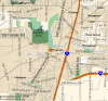
Below you can see SpatialMatch's map displaying homes currently for sale in Tualatin.
- Click here to view a video tutorial about the SpatialMatch® Search system.
- To determine a property exposure to landslides and earth quakes, insert the address of the property into the LIDAR system.
- Your feedback about the SpatialMatch system is welcome by emailing This email address is being protected from spambots. You need JavaScript enabled to view it. .
_______________________________________________
1Drive Time to Downtown Estimated commuting time obtained from Yahoo Maps and Google Maps. Drive time was calculated from a central intersection in each neighborhood to Pioneer Courthouse Square during the morning peak commute time.
2Demographics Data Numbers were obtained from Census 2010 and www.portlandmaps.com.
3Shopping and Services Numbers were determined from local directory listings and county/municipal library systems.
4School Report Card Grades "O" = Outstanding; "S" = Satisfactory; "I" = In Need of Improvement.
5Real Estate Values Data on real estate values provided by RMLStm. Distressed properties refer to the percentage of total homes sold that were short sales and bank-owned properties.