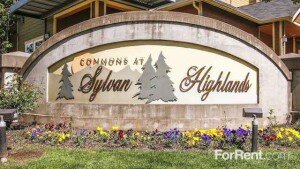
Guide to the Sylvan-Highlands Neighborhood in Portland, Oregon
 This heavily wooded area just west of downtown has narrow winding streets and is located in the Southwest section of Portland. The north border is the Hillside neighborhood, the east border is Arlington Heights, the south border is Southwest Hills and the west border is an area of unincorporated Washington County commonly called West Slope.
Its attraction is the quick drive to downtown and its closeness to Washington Park with access to the Hoyt Arboretum trails.
Many of the houses that now face Highway 26 are from the 1930s and 1940s when houses were built along the south edge of the neighborhood near the Portland Racquet Club. The rest of the neighborhood sprang up in the 1950s, ’60s, and ’70s. And the change continues as new condos and townhomes are being constructed on the western edge of the neighborhood.
The neighborhood association supported the tunnel for light rail, which could have run above ground through the residential area. Residents also expressed concerns when the Oregon Department of Transportation began to redesign the U.S. 26 highway between Sylvan and Camelot Court, including a new overpass bridge. The overpass project now has a bridge with stanchions at each end that read ‘Sylvan’ on a background of trees. The design that came from the neighborhood.
You see a few of the Sylvan-Highlands residents walk from their homes to the MAX Light Rail stop at the Zoo to either head into downtown for work or out to the west suburbs for work in one of the high-tech companies.
Origin of the Name of Sylvan-Highlands
The word ‘sylvan’ is derived from Silvanus, the Roman deity of the woods. The name seems appropriate for an area that is more like a forest than an urban neighborhood.
Schools in the Sylvan-Highlands Neighborhood
Find your school attendance area or a school site and view the boundary area using School Locator. Read how to use the interactive map by clicking on the “Information” icon (circle with an “i” in the center).
- Schools in the Neighborhood A list of public and private schools in the Sylvan-Highlands neighborhood.
- Public Schools in the Neighborhood Elementary schools: Ainsworth Elementary and Chapman Elementary. Middle school: East-West Sylvan. High school: Lincoln High School.
- School Report Cards Report Cards for schools and districts in Oregon. Select “Portland SD 1J” to view individual schools within the Portland Public School District.
Sylvan-Highlands Home Styles
You will find a few older homes along with homes built in the 50s and 60s. Homes facing west have a view of the coastal mountain range. The last few years have seen some new condos being built along with townhomes.
Most homes in Sylvan-Highlands are owner occupied. An apartment complex is located at the south end of the neighborhood near the business district. Most of the detached single-family homes are owner-occupied.
Portland Monthly Magazine Guide to Neighborhoods
 In their April issue every year, the Portland Monthly Magazine features the past year home prices along with other information about Portland neighborhoods and suburban communities. To read the magazine’s latest stories and numbers visit the Real Estate section.
The numbers on the website and the printed magazine are divided into four sections (real estate, people, crime, and lifestyle) on each of the Portland 90 plus neighborhoods as well as about 25 suburban communities. The website offers over 50 items of information about each Portland neighborhood and suburban community.
The magazine added a feature on their website for homes sold in 2014 and it’s also available for homes sold in 2015 — an interactive map where you can click on a neighborhood and a pop-up displays five items (1-year median price change, 5-year median price change, median gross rent, walkability score and percent of newcomer) for a Portland neighborhood as well as a suburban community. Note the detailed numbers for each of the four sections for homes sold in 2015 are displayed below the map.
To visit the magazine’s website latest stories and numbers visit their Real Estate section — click on “Neighborhoods” to view the numbers for the Portland neighborhoods and click on “Suburbs” for the numbers on communities in the metro area. Note the detailed numbers for each of the four sections for homes sold in 2014 and 2015 are displayed below the map. To access the Portland neighborhoods and metro communities demographic data and home prices by year:
- 2014 Demographics and Home Prices
- 2015 Demographics and Home Prices
- 2016 Demographics and Home Prices
Sylvan-Highlands Demographics Below you will find some facts about the Sylvan-Highlands neighborhood gleaned from the magazine’s website. A few numbers can tell much about the character of a neighborhood. You can view more data about Sylvan-Highland by visiting the Portland Monthly’s website.
- Average year homes built in the neighborhood: 1971
- Percent of residents below poverty level: 4.4%
- Percent of neighborhood size with parks: 12%
- Live within half-mile of a park: 32%
- Commute by bike or walking: 4.5%
1Sylvan-Highlands Home Prices: 2007-2016
- Number of Homes Sold in Sylvan-Highlands—► 38 homes were sold in 2016 and there were no distressed sales. 41 homes were sold in 2015 and 7.3% were distressed sales. 22 homes were sold in 2014 and 5% were distressed property sales. 20 homes were sold in 2013 and 5% were distressed sales. 22 homes were sold in 2012 and 18% were distressed sales. 30 homes were sold in 2011 and 57% were distressed sales. 14 homes were sold in 2010 and 36% of these were distressed sales.
- Median Price for Homes Sold in Sylvan-Highlands—► $636,275 in 2016, $583,500 in 2015, 476,500 in 2014, $476,000 in 2013, $372,325 in 2012, $304,705 in 2011, $427,500 in 2010, $500,000 in 2009, $530,000 in 2008, and $585,000 in 2007.
- Average Cost per Square Foot—► $238 in 2016, $282 in 2015, $206 in 2014.
- 1-Year Median Sales Price Change in Sylvan-Highlands—► The change was 14% in 2016, The change was 22.5% in 2015, 0% in 2014, 28% in 2013, 22% in 2012, -27% in 2011, and -15% in 2011.
- 5-Year Average Sales Price Change in Sylvan-Highlands—► 71% change for the years 2012-2016. 91.5% change for the years 2011-2015. 2010 to 2014 the change was 11%. 2009 to 2013 the change was 11%. 2008 to 2012 the change was -13%. 2007 to 2011 the change was -43%. 2006 to 2010 the change was 14%.
- Portland Metro Area Median Home Price—► $395,000 in 2016, $308,000 in 2015, $288,500 in 2014, $265,000 in 2013, $235,000 in 2012, $221,000 in 2011, $239,900 in 2010, $247,000 in 2009, $278,000 in 2008, and $290,000 in 2007.
- Portland Metro Area Average Home Price—► $347,000 in 2016, $354,500 in 2015, $333,000 in 2014, $310,600 in 2013, $275,000 in 2012, $263,300 in 2011, $282,100 in 2010, $289,900 in 2009, $330,300 in 2008, and $342,000 in 2007.
Please be aware that the above figures are subject to error and are intended as guidelines only.
Find a Home in Sylvan-Highlands Neighborhood
- Homes for Sale in the Sylvan-Highlands Neighborhood — View on all devices except Apple® mobile devices. To view homes for sale in the Sylvan-Highlands neighborhood on Apple® mobile devices key in “Sylvan-Highlands” in the “Location” field and click on the “Search Now” icon.
- Homes for Sale in the Sylvan-Highlands Neighborhood — View on all devices. Photos of homes displayed along with detailed description of property.
- Search for Homes — Search on all devices. Map-based on devices configured with Adobe Flash and Javascript and text-based on any device.
Homes for Sale in Sylvan-Highlands
4318 Sw Fairview Circus Portland, OR 97221

5445 Sw Burton Dr Portland, OR 97221

1430 Sw Highland Rd Portland, OR 97221

614 Sw Arboretum Cir Portland, OR 97221

5095 Sw Barnes Rd Portland, OR 97221

1180 Sw Skyline Blvd Portland, OR 97221

5929 Sw Taylor St Portland, OR 97221

1722 Sw Highland Pkwy Portland, OR 97221

1625 Sw Skyline Blvd Portland, OR 97221

1579 Sw Highland Pkwy Portland, OR 97221

Parks and Gardens in the Sylvan-Highlands Neighborhood
Hoyt Arboretum (232 acres) offers ten miles of walking trails and adjoins the neighborhood. Washington Park with its numerous attractions also borders the Sylvan-Highlands neighborhood.
Sylvan-Heights has 67 acres of park land and open spaces according to Metro and the Portland Department of Parks and Recreation.
Walking in Sylvan-Highlands
The SW Trails Group is a committee of Southwest Neighborhoods Inc that uses volunteer efforts to make trail improvements, lead walks, work with Safe Routes to School, plan and advocate for pedestrian and bicycle safety and other improvements in SW Portland Their walks are the second Saturday of each month, meet at 9 a.m. sharp under the Hillsdale Oak, behind the Dance Studio at SW Sunset Blvd and SW Capitol Highway near the concrete bleachers of the Wilson football field.
Hoyt Arboretum (232 acres) offers ten miles of walking trails and adjoins Washington Park and borders the Sylvan-Highlands neighborhood. The Arboretum’s plant collection is made up of over 8,000 individual trees and plants, representing over 1,000 species, many of which are accessible and well-labeled.
Walk Score helps you find a walkable place to live. Walk Score is a number between 0 and 100 that measures the walkability of any address. Portland is the 14th most walkable city in the U.S. with a Walk Score of 63, a Transit Score of 50 and a Bike Score of 72. There are over 3,000 restaurants and coffee shops in Portland. People in Portland can walk to an average of five restaurants and coffee shops in five minutes.
The Walk Score for the Sylvan-Highlands neighborhood is 17, the Transit Score is 4, and the Bike Score is 23.
Sylvan-Highlands
Car-Dependent
Walk Score®
17
out of 100
Sylvan-Highlands is the 85th most walkable neighborhood in Portland.

More About Sylvan-Highlands
Learn more about the Sylvan-Highlands neighborhood by visiting Portland Maps. The site offers a list of businesses, demographic data, crime stats, parks, schools, aerial photos, maps, elevation, and more for the Sylvan-Highlands neighborhood. All you need is a property address within the neighborhood — use “1626 SW 58th Avenue” or an address of your choice.
- Neighborhood Association Website Sylvan-Highlands.
- Location Take West Burnside out of downtown and when you approach Skyline Boulevard, look to your left.
- Sylvan Highlands Boundaries U.S. 26 forms the south boundary for the neighborhood, with West Burnside Road marking the north end. The west edge of Washington Park is the east boundary and the Washington County line is the west boundary.
- Map of Boundaries Sylvan Highlands
- 2Drive Time to Downtown About ten minutes – more if you’re traveling West Burnside during rush hour.
- Topography Moderate rolling hills, very wooded, winding roads. Very few homes have views.
- Streets and Sidewalks Not a straight street in the neighborhood and no sidewalks.
- Public Transportation TriMet has four bus routes in the neighborhood. Number 20 goes up Burnside Road and Nos. 58 and 63 go to the Sylvan overpass. A MAX light rail stop for the blue and red lines at the Oregon Zoo is within walking distance for residents living on the east side of the neighborhood. Transit Score provides a 0-100 rating indicating how well an address is served by public transportation. Ratings range from “Rider’s Paradises” to areas with limited or no nearby public transportation.
- Commuting 0.7% of the neighborhood residents commute by public transportation, 0.9% by bike and 2.5% by walking.
- 3Census 2010 Demographics Population: 1,317. Area size: 697 acres. Average population density: One person per acre. Number of households: 575. Average size of household: 1.94 persons. Median household income: $117,641. Families with children: 23.2%. Percent of homeowners: 86%. Percent of renters: 14%. Diversity: 9.6% non-Caucasian. More census data about Sylvan-Highlands at Portland Online and City Data.
- 4Crime Stats There were 29 property crimes (assault, arson, burglary, larceny, robbery, theft from auto, vehicle theft) in 2014. There were three violent crimes (aggravated assault, homicide, robbery, rape) committed in 2014. There were 35 crimes per 1,000 residents in 2014. For the latest crime statistics and historical data for the Sylvan-Highlands neighborhood, visit the Portland Police Bureau website.
- Sex Offenders Click here for the State of Oregon Sex Offender Inquiry System. After agreeing to the “Conditions of Use Statement” you will be redirected to an “Enter Search Criteria” page. Insert a zip code in the “Zip” field and click on the “Query” button. Sylvan-Highlands zip code(s): 97021, 97025.
- 5Shopping and Services This neighborhood have a few commercial establishments on SW Skyline Boulevard. You will find a convenience store, cleaners, a couple of gas stations, and a pizza take-out. It is an easy 7-8 minute drive to the Northwest District where you will find all kinds of shopping.
- Eating Out Pizzicato, a well-regarded pizza take-out is located at the intersection of Highway 26 and SW Skyline Boulevard. Residents are minutes from restaurants in Northwest District and downtown.
- Walking Score Most of the addresses have a walking score in the 40s (not walkable) as recorded by Walk Score.
- Public Library You have to go downtown to the Multnomah County Central Library or to the Northwest District branch located at 2300 NW Thurman Street.
- Who Lives in Sylvan-Highlands With its proximity to downtown, the Sunset Highway, freeways and the light-rail line, Sylvan Highlands has attracted a diverse group of residents. Former Governor Tom McCall lived in the neighborhood when he worked for The Oregonian and Channel 8. The median age is 45. It has the second highest median household income among the 95 Portland neighborhoods. Once you live in Sylvan-Highlands you stay as 69% of the residents have lived in their home since 2004 or earlier.
- Cars in the Neighborhood SUVs, luxury autos, and a few vans (soccer moms).
- 6Biking The neighborhood has 1.7 miles of bike lanes.
Map of Sylvan-Highlands Neighborhood
_____________________________________________