Guide to the Sellwood-Moreland Neighborhood in Portland
Sellwood-Moreland is a neighborhood overlooking the Willamette River in Southeast Portland. It is bordered by the Brooklyn neighborhood to the north, Eastmoreland to the east, and the city of Milwaukie to the south. Sellwood-Moreland is located five miles south of downtown Portland and on the east side of the river.
Here’s our list of ingredients for a thriving community: Parks, shopping, restaurants, access to public transportation, library, coffee shops, food markets, movie theater, and sidewalks. It would be a bonus if the community had quality schools and kids could walk or bike to school. Sellwood-Moreland meets all of these conditions so you may want to investigate the neighborhood as a possible place to live.
Sellwood-Moreland has numerous health clubs and here’s a list: EcoPower Fitness, Sellwood Yoga, and Snap Fitness. The Sellwood Community Center has exercise classes for all ages. Our favorite is Conniyoga because we feel like a “million bucks” after an hour of relaxing yoga.
Couples with children have discovered the neighborhood. In the 2000 census, there were 1,834 children under 18 living with their parents, and this number jumped to 2,068 in the 2010 census. An increase of 240 kids and 190 of these youngsters were under five years of age.
The Office of Neighborhood Involvement, the agency that oversees neighborhood associations, combines the neighborhoods of Sellwood and Westmoreland into Sellwood-Moreland. Westmoreland is on the east side of the community bordering McLoughlin Boulevard, and Sellwood is on the west side bordering the river. These are two distinct neighborhoods, and each has their business district and parks. Ask any resident and they will tell you that they either live in Sellwood or Moreland and seldom reply that they live in Sellwood-Moreland.
Carl Abbott has a write up about former Governor Barbara Roberts living in Sellwood-Moreland in his book Greater Portland.
Barbara Roberts loves her neighborhood. When she returned to Portland from Boston in 1998, she picked a modest Dutch Colonial in southeast Portland’s Westmoreland neighborhood. A long established commercial street is only three blocks away. Roberts can walk to the grocery, the hardware store, a movie theater, and a choice of banks and restaurants. Roberts returned home because she wanted “to feel connected.” In Portland’s Sellwood-Westmoreland district she found a small town ambience that reminded her of Sheridan, the Oregon town where she grew up. Westmoreland, she says, “feels like a neighborhood should feel,” with a mix of elderly, young couples, and children. Residents are politically active, with high voter registration and turnout. They notice what others do with their yards and gardens; when she took down an aging tree that threatened her house and her neighbor, everyone had a comment. People in the neighborhood restaurant/bar treat her as family, shooing away belligerent customers who want to upbraid her for her mistakes in Salem (she backed a deeply unpopular sales tax to fund state services).
History of Sellwood-Moreland
The Sellwood-Moreland neighborhood began as the 1847 land claim of Henderson Llewelling who used the land to raise experimental strains of fruit. After Llewelling died in 1866, the 320-acre property was purchased by Rev. John Sellwood. In 1882, Sellwood sold 160 acres to several investors who laid out the town of Sellwood. Sellwood was incorporated in 1887 and then merged with Portland five years later. The area grew when streetcars began serving the area in 1892.
In early 1909 the 500-acre Crystal Spring livestock farm was platted into the subdivisions of Eastmoreland and Westmoreland. The developers promoted their developments as modern subdivisions which would be sold with sidewalks and curbs in place. Westmoreland’s target market were the new white collar professionals who rode the streetcar to jobs in downtown Portland. The Eastmoreland Golf Course was also marketed to residents of both Westmoreland and Eastmoreland. By implication, Sellwood was an old-fashioned farm town.
The first quarter of the 20th century the two communities were in competition. As homes rose in Westmoreland, the newly-established local newspaper, the Sellwood Bee, became alarmed. It warned that a new commercial area might appear that would undermine the businesses in Sellwood. The first business, a doctor’s office, was constructed at the southwest corner of Bybee and Milwaukie in 1911. As the new business area grew, competition between Sellwood and Westmoreland began and did not end for fifty years.
Around 50 brown antique plaques were created for the merchants along 13th Avenue to display on their storefront counters or install along their building fronts. These historic signs became a favor of the newly created Antique Row Dealers, which reached a high of over 25 in the 1990s. There are still a handful of antique shops along 13th Avenue today and about 30 of the plaques are still on display.
Origin of the Names Sellwood and Moreland
The Sellwood part comes from Rev. John Sellwood, an Episcopal minister who held the land for a few years. Moreland is named after Julius Caesar Moreland, a successful real estate developer and also a prominent county judge. Many refer to Moreland as Westmoreland to differentiate it from their neighborhood directly east that is called Eastmoreland.
Schools in the Sellwood-Moreland Neighborhood
Find your school attendance area or a school site and view the boundary area using School Locator. Read how to use the interactive map by clicking on the “Information” icon (circle with an “i” in the center).
- Schools in the Neighborhood A list of public and private schools in the Sellwood-Moreland neighborhood.
- Public Schools in the Neighborhood Elementary school: Duniway and Llewellyn. Middle school: Sellwood Middle School. High school: Cleveland High School.
- School Report Cards Report Cards for schools and districts in Oregon. Select “Portland SD 1J” to view individual schools within the Portland Public School District.
As a result of the increase in children, the neighborhood elementary school (Llewellyn) was crowded until they changed the boundaries. A few years ago the district was ready to close the school and consolidate it into another elementary. The Portland Public Schools (PPS) in November 2012 approved a boundary change. A portion of the Llewellyn boundary was shifted to Duniway Elementary in Eastmoreland (the neighborhood directly east of Sellwood-Moreland). So now incoming students residing in the Sellwood residential area are shifted from Llewellyn to Duniway if they reside in the area from S.E. Ochoco Street north to Tacoma Street, and from S.E. 17th Avenue east to McLoughlin Boulevard.
This change occurred in September of 2013 for new PPS students, including incoming kindergartners, new move-ins, or transfers from private schools, in grades one through five. Younger siblings of Llewellyn students have “a guaranteed space” at Llewellyn Elementary School.
Shopping
The community has two shopping areas. Coming off the Sellwood Bridge heading east, you encounter the first one that is in the Sellwood neighborhood at the intersection of Tacoma Street and 13th Avenue. It’s the home of the Sellwood New Seasons Market along with antique stores, restaurants, and other shops. The other commercial area is the Westmoreland neighborhood along SE Bybee and SE Milwaukie, and it has a market called QFC (a division of Kroger’s). The Westmoreland area has a movie theater, coffee shops, restaurants, a florist, clinic, and a hardware store (they actually wait on you). It also has antique stores. The Moreland Theater is one of the last single-screen movie theaters in Portland. A mix of first runs, art films, and lesser known treats. The Moreland seats 450 patrons and when the curtain rolls back, the movie begins. You don’t have to sit through the 15 minutes of “coming attractions”. And the popcorn is reasonably priced.
A favorite place in Sellwood-Moreland is a bakery called Piece of Cake at 8306 SE 17th Avenue. The bakery is without walls so you can see the entire operation including ovens, stoves, etc. Here’s Marilyn (the owner on the left) and her assistant decorating a cake. Visit their website at Piece of Cake Bakery to view their goodies to include many gluten-free baked goods.
If you’re interested in a PlayStation 3 or Xbox 360, don’t bother stepping into Cloud Cap Games. But if you want old-fashioned board games fill the shelves at this Sellwood shop. James and Kirsten Brady, the owners of Cloud Cap Games, favor the low-tech joys of what one customer calls “analog” games because they require none of the batteries or electrical outlets that power today’s digital gaming explosion. Board games are their specialty, but they also carry a good selection of card sets, puzzles and other game-related goods. It’s family-friendly atmosphere and they have a whole shelf dedicated to children’s games. And while many are internationally popular, the Bradys also stock locally made wares, including games, dice bags, and cribbage boards. Soon after opening, the Bradys started hosting Wednesday game nights at the store. Word spread quickly, and every week players have filled two tables in a side game room and a third table just inside the main store and this has grown to other times for groups gathering to play games. Cloud Cap Games is located at 1226 SE Lexington Avenue.
What a bookstore should look like! Wallace Books is a house that’s been jammed full of new and used books, and there is no nook or cranny that isn’t swamped with piles and shelves. Julie Wallace, a former Powell’s Bookstore employee, opened her own bookstore a few years ago in a 1,150-square-foot yellow house on 7241 SE Milwaukie Avenue. Her business is based on the belief that people want the personal touch from their bookseller. She has time to talk to people about books, and she stays in business by catering to people who want personalized service. When Wallace studied the 1990 census, she learned that Sellwood/Westmoreland was becoming younger and more diverse; the average income, education levels, and age groups were good for such a business. As a result of her research, the children’s selection of books is outstanding.
During the summer, a Farmers Market with farm fresh local produce, nursery stock, cut flowers, local cheese, baked goods, bread, fish, meat, prepared food, specialty items is held every Wednesday mid-May through September, mid-afternoon until early evening at SE Bybee and 14th Avenue. For a complete list of all the business establishments in the community, visit the Sellwood-Moreland Business Association (SMBA) website. You can also download a walking tour map of the SMBA businesses or view an interactive map on your smartphone and tablet.
View The Oregonian/OregonLive slideshow of “10 Favorite Shops” in the neighborhood.
Events and Issues
Sellwood Riverfront Park, overlooking the Willamette River, is the site on the first Sunday each August, for the Sundae on the Park − a civic event presented by the neighborhood association that features ice cream sundaes for a quarter, inexpensive hot dogs, old fashioned live entertainment, and displays and booths featuring historic topics related to the neighborhood. All of it, on the most unfailingly sunny weekend of the year, according to Oregon weather statistics.
Traffic impacts on Tacoma Street are a longstanding issue in the Sellwood-Moreland neighborhood. Every day more than 30,000 vehicles travel over the Sellwood Bridge through the heart of the neighborhood causing congestion all along Tacoma Street. Read about the proposed solutions at Tacoma Street Project.
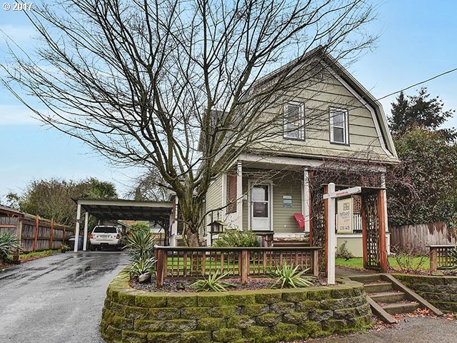
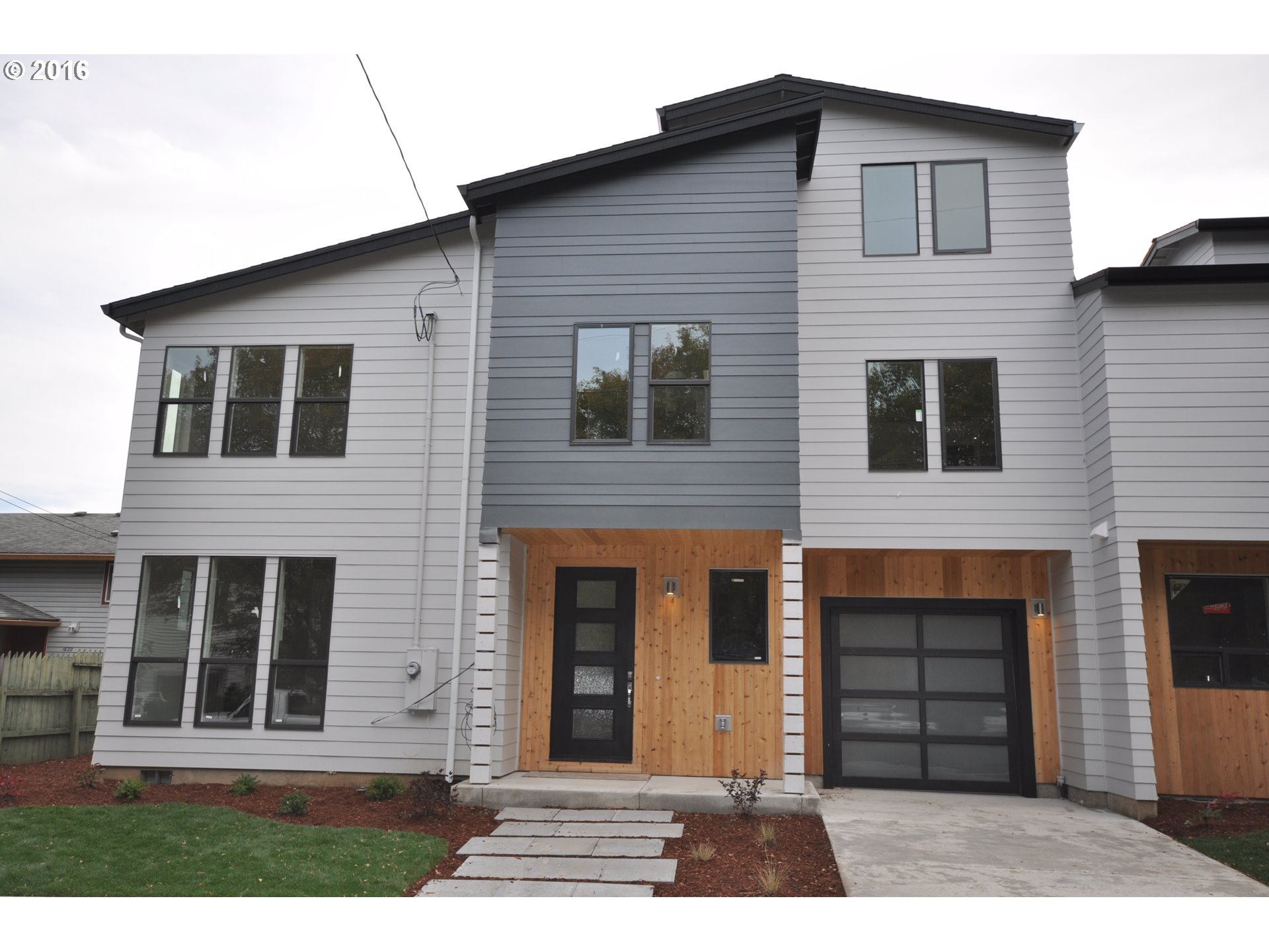
Sellwood-Moreland Home Styles
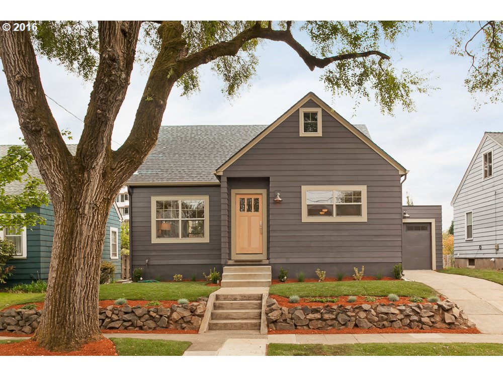
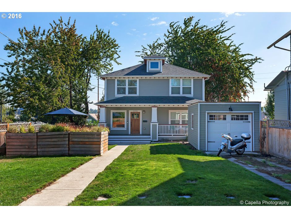
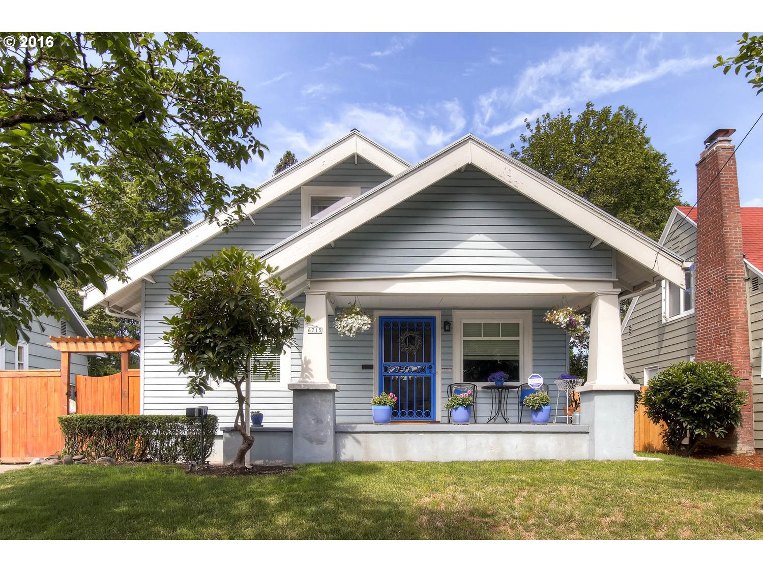
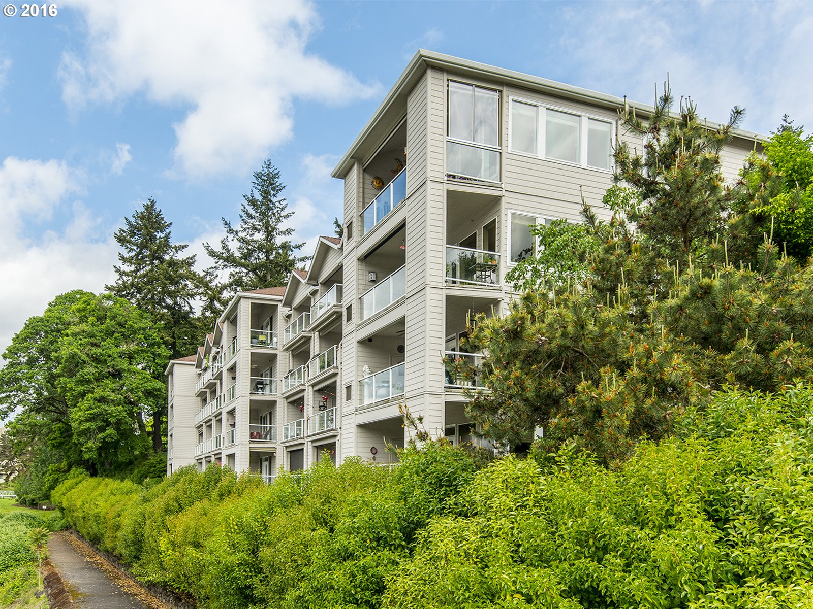
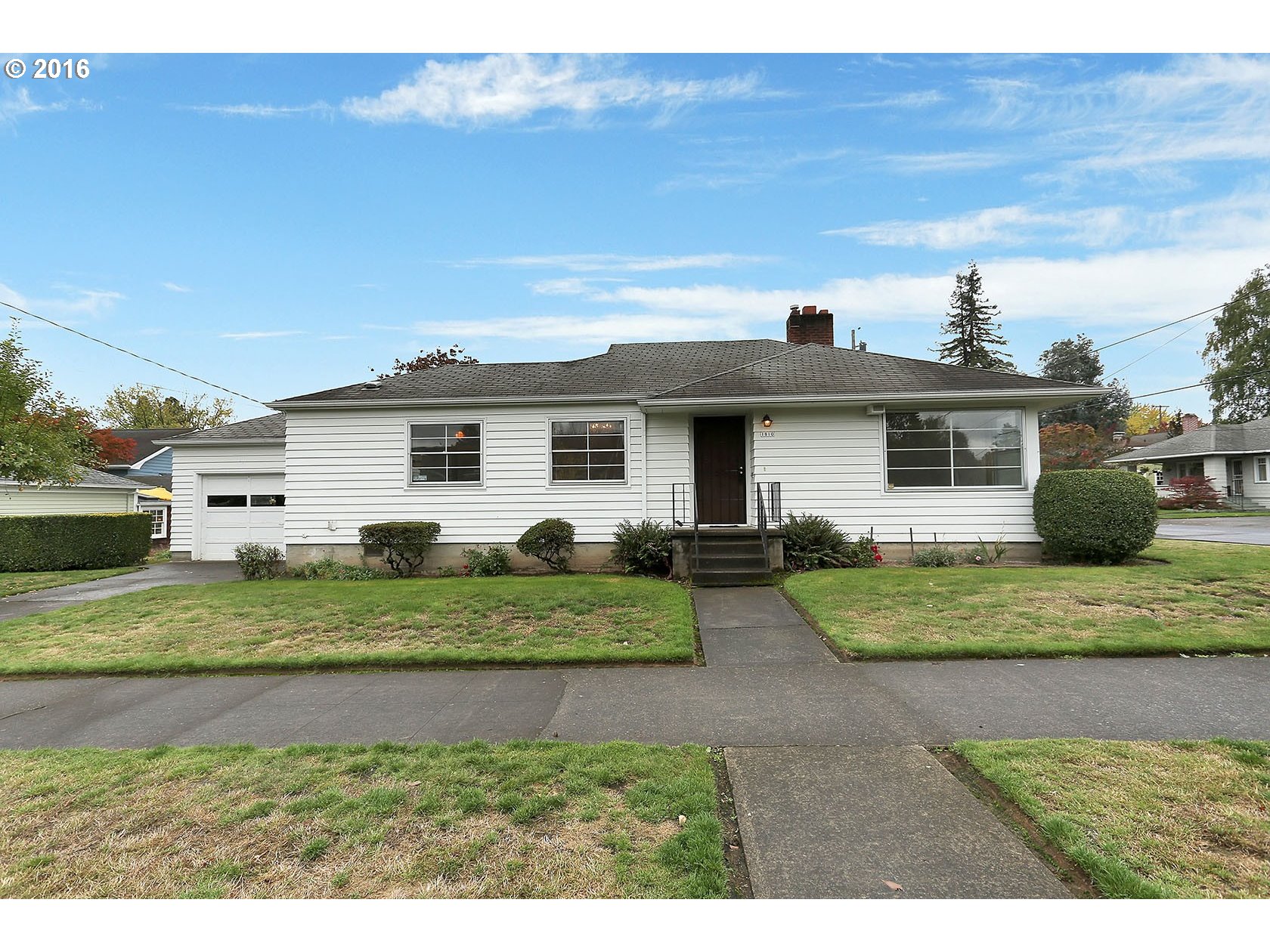
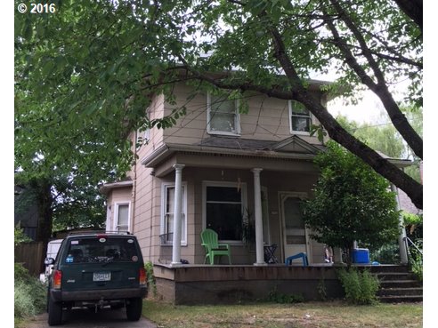
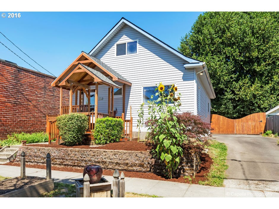
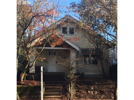
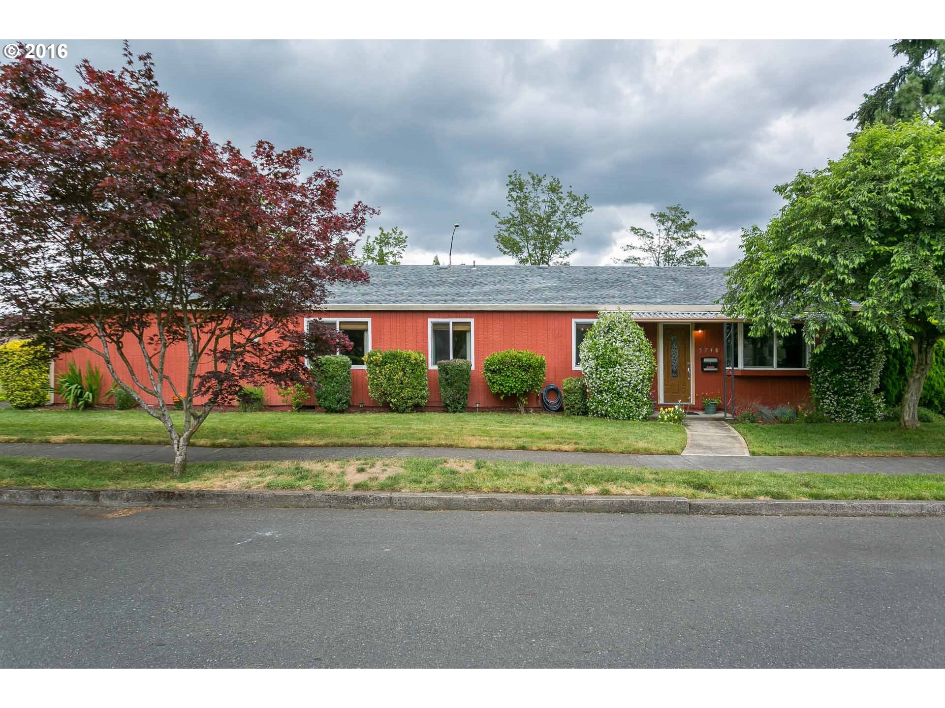
One of the first thing you notice driving around the community is the variety of homes within a given block. You will notice Bungalows, Cottages, Victorians mixed with a number of small nondescript one-story homes. Over the years, many of the homes in the neighborhood have been purchased by ambitious people who knew a bargain when they saw one. With some sweat, they have done extensive remodeling and adding square footage to their homes. And there are still homes available in the neighborhoods waiting for someone to give them a facelift.
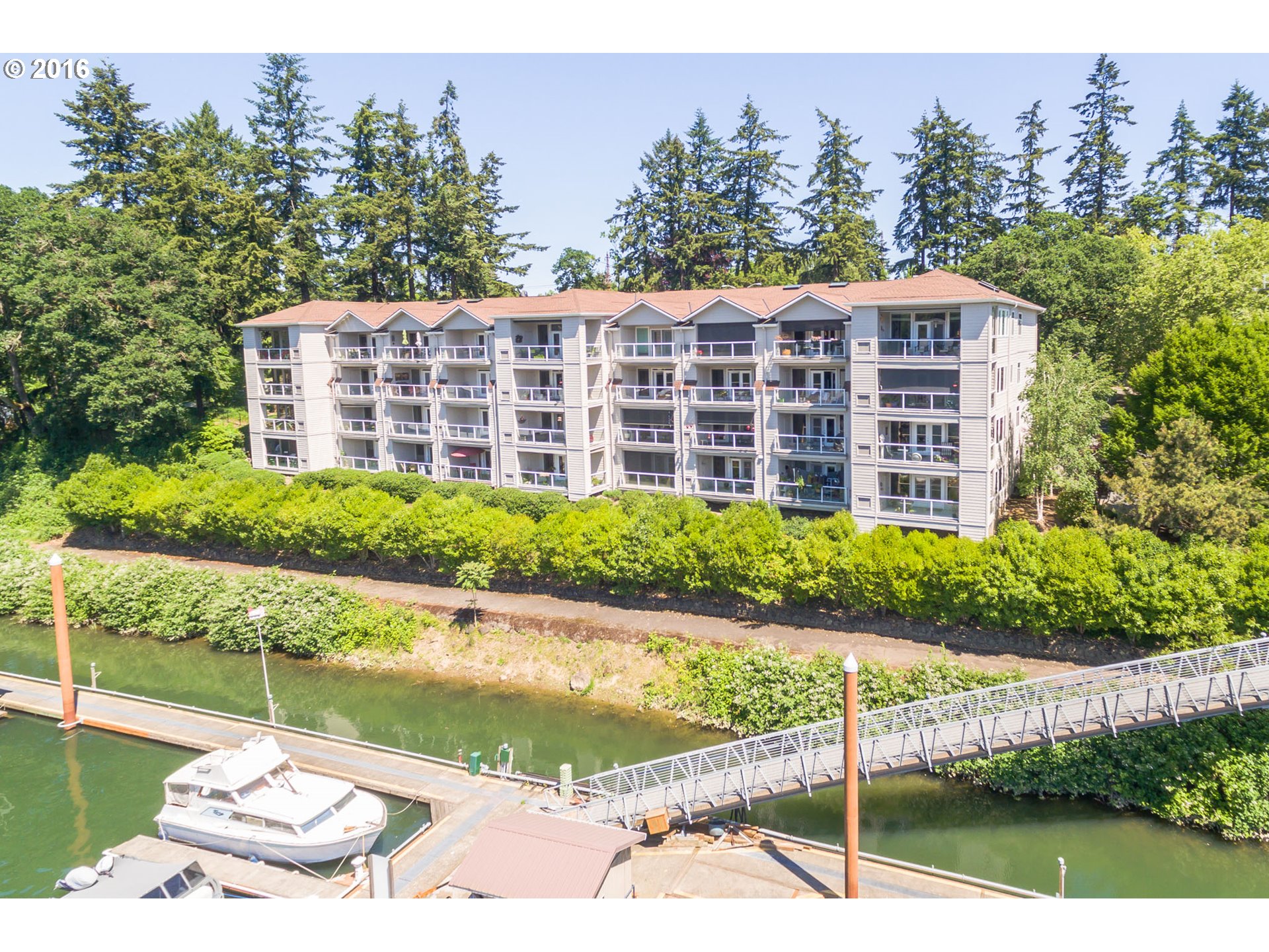
The area along the west end of Sellwood near the Oaks Bottom Refuge have some elegant homes. Both the area south and north of the Sellwood Bridge have condo developments and many of the homes have a view of the river life. There are 4-5 townhouse developments south of Tacoma. Also in the housing mix are a few floating homes located north of Oaks Amusement Park.
Architectural historian Thomas Hubka, writing in OregonLive.com/The Oregonian, states that four Sellwood houses best represent Portland’s first major Boom Era of house building following the Lewis and Clark Exposition of 1905: the Four-Square, the Hip-Roof Bungalow, the Pyramid and the Porch-Gable. We can find these houses throughout Sellwood, for example, the district west of 13th Avenue and north of Tacoma Street bordering the Willamette River. Here you will see a collection of dwellings that local builders concocted from pattern books and builders’ catalogs for an up-and-coming, suburban middle class just after incorporation into the city in 1893.
Portland Monthly Magazine Guide to Neighborhoods
 In their April issue every year, the Portland Monthly Magazine features the past year home prices along with other information about Portland neighborhoods and suburban communities. To read the magazine’s latest stories and numbers visit the Real Estate section.
The numbers on the website and the printed magazine are divided into four sections (real estate, people, crime, and lifestyle) on each of the Portland 90 plus neighborhoods as well as about 25 suburban communities. The website offers over 50 items of information about each Portland neighborhood and suburban community.
The magazine added a feature on their website for homes sold in 2014 and it’s also available for homes sold in 2015 — an interactive map where you can click on a neighborhood and a pop-up displays five items (1-year median price change, 5-year median price change, median gross rent, walkability score and percent of newcomer) for a Portland neighborhood as well as a suburban community. Note the detailed numbers for each of the four sections for homes sold in 2015 are displayed below the map.
To visit the magazine’s website latest stories and numbers visit their Real Estate section — click on “Neighborhoods” to view the numbers for the Portland neighborhoods and click on “Suburbs” for the numbers on communities in the metro area. Note the detailed numbers for each of the four sections for homes sold in 2014 and 2015 are displayed below the map. To access the Portland neighborhoods and metro communities demographic data and home prices by year:
- 2013 Demographics and Home Prices
- 2014 Demographics and Home Prices
- 2015 Demographics and Home Prices
Sellwood-Moreland Demographics Below is some facts about the Sellwood-Moreland neighborhood gleaned from the magazine’s website. A few numbers can tell much about the character of a neighborhood.
- Average year homes built in the neighborhood: 1949
- Percent of residents below poverty level: 23%
- Percent of neighborhood land area that is in parks: 4%
- Percent of residents that live within a 1/2 mile of a park: 85%
- Percent of residents that commute by bike or walking: 12.9%
1Sellwood-Moreland Home Prices: 2007-2015
- Number of Homes Sold in Sellwood-Moreland—► 228 homes sold in 2015 and 2.2% were distressed sales, 200 homes sold in 2014 and 2% were distressed sales, 231 homes sold in 3013 and 3% were distressed sales. 175 homes were sold in 2012 and 8% were distressed sales. 148 homes were sold in 2011 and 14% were distressed sales. In 2010 there were 138 homes sold and 9% distressed sales.
- Median Price for Homes Sold in Sellwood-Moreland—► $459,500 in 2015, $406,250 in 2014, $360,000 in 2013, $315,000 in 2012, $321,500 in 2011, $338,750 in 2010, $329,500 in 2009, $350,000 in 2008, and $354,800 in 2007.
- Average Cost per Square Foot—► $233 in 2015, $212 in 2014.
- 1-year Median Sales Price Change in Sellwood-Moreland—► The change was 10.9% in 2015, The change was 13% in 2014, the change was 14% in 2013, the change was -2% in 2012, the change was -4% in 2011, and in 2010 the sales price change was 4%.
- 5-year Median Sales Price Change in Sellwood-Moreland—► 2011 to 2015 the sales price change was 40.1%. 2010 to 2014 the sales price change was 16%. 2009 to 2013 the sales price change was 3%. 2008 to 2012 the sales price change was -10%. 2007 to 2011 the sales price change was -9%. 2006 to 2010 the sales price change was 0%.
- Portland Metro Area Median Home Price—► $308,000 in 2015, $285,000 in 2014, $310,600 in 2013, $235,000 in 2012, $221,000 in 2011, $239,900 in 2010, $247,000 in 2009, $278,000 in 2008, and $290,000 in 2007.
- Portland Metro Area Average Home Price—►$354,500 in 2015, 333,000 in 2014, $265,000 in 2013, $275,000 in 2012, $263,300 in 2011, $282,100 in 2010, $289,900 in 2009, $330,300 in 2008, and $342,000 in 2007.
Please be aware that the above figures are subject to error and are intended as guidelines only.
Find a Home in Sellwood-Moreland
- Homes for Sale in the Sellwood-Moreland Neighborhood —View on all devices except Apple® mobile devices. To view homes for sale in the Sellwood-Moreland neighborhood on Apple® mobile devices key in “Sellwood Moreland” in the “Location” field and click on the “Search Now” icon.
- Displays Homes for Sale in the Sellwood-Moreland Neighborhood — View on all devices. Photos of home displayed along with detailed description of the property.
- Search for Homes — Search on all devices. Map-based on devices configured with Adobe Flash and Javascript and text-based on any device.
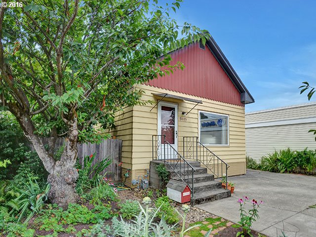
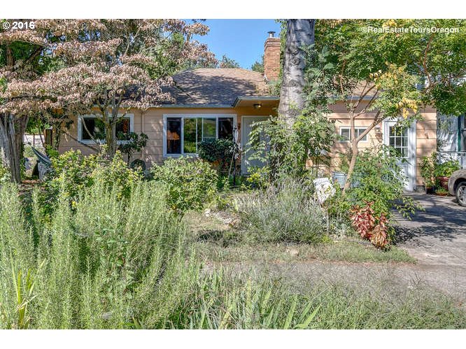
Homes for Sale in Sellwood-Moreland
1624 Se Tacoma St Portland, OR 97202
8415 Se 17th Ave Portland, OR 97202
1612 Se Clatsop St Portland, OR 97202
941 Se Bidwell St Portland, OR 97202
6522 Se 22nd Ave Portland, OR 97202
5306 Se Milwaukie Ave Portland, OR 97202
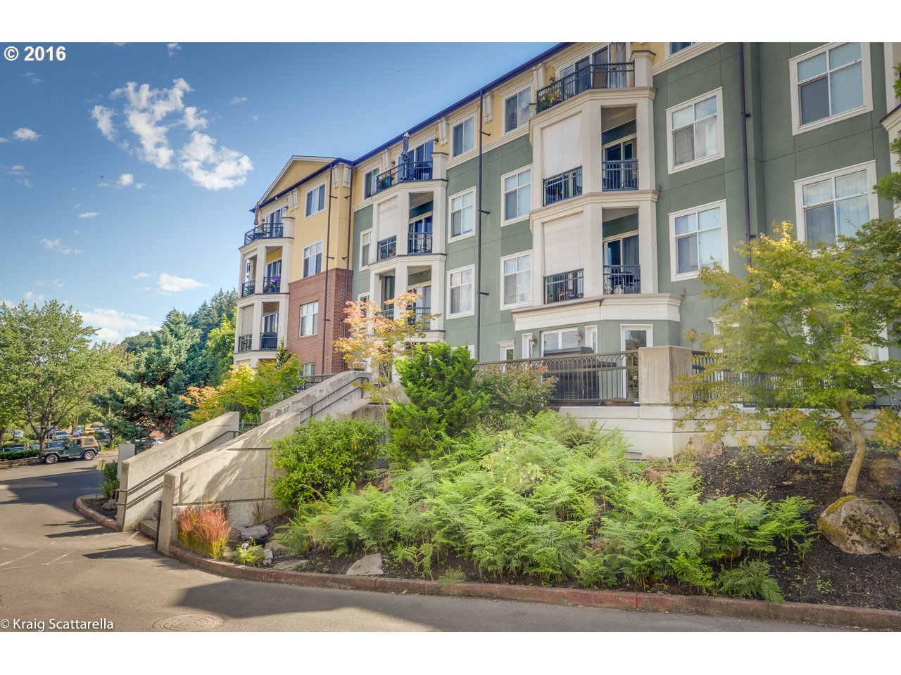
525 Se Marion St #19 Portland, OR 97202
6715 Se 21st Ave Portland, OR 97202
525 Se Marion St #10 Portland, OR 97202
1942 Se Ellis St Portland, OR 97202

1810 Se Yukon St Portland, OR 97202
1514 Se Ellis St Portland, OR 97202
1723 Se Harney St Portland, OR 97202
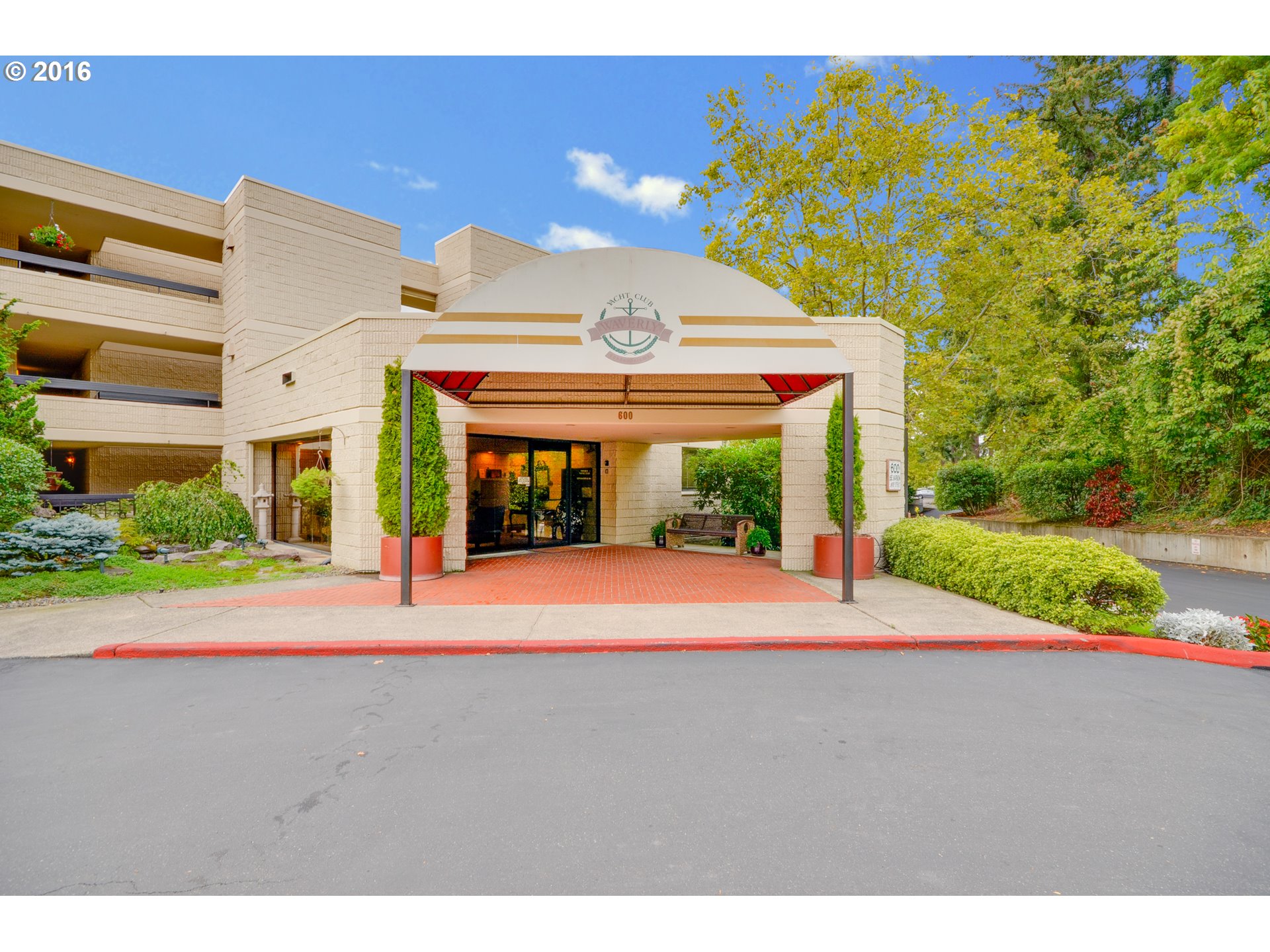
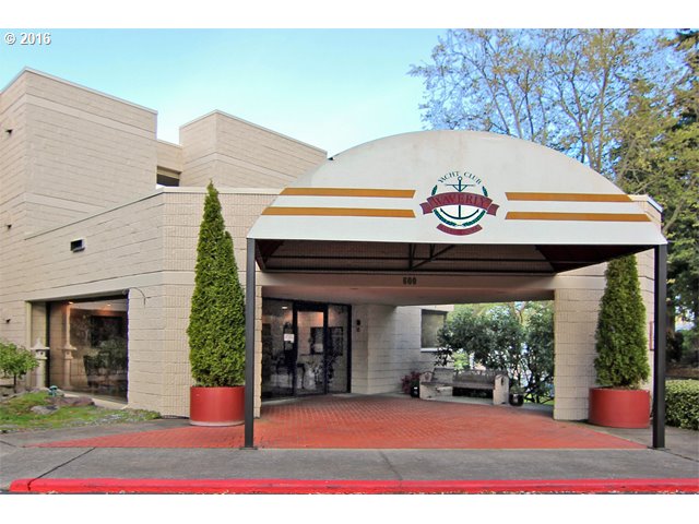
600 Se Marion St Portland, OR 97202
196 Se Spokane St Portland, OR 97202
600 Se Marion St #102 Portland, OR 97202
5434 Se Milwaukie Ave Portland, OR 97202
1316 Se Lexington St Portland, OR 97202

5740 Se 23rd Ave Portland, OR 97202
600 Se Marion St #110 Portland, OR 97202

Parks in Sellwood-Moreland
The neighborhood is blessed with a river park, a wildlife refuge, along with a couple of parks that include basketball courts, baseball/softball fields, swimming pool, and play areas. Plus there’s a private amusement park!
- Sellwood Riverfront Park is a 7.85-acre park on the Willamette River. It has a boat dock, dog off-leash area, paths, and picnic tables.
- The 16-acre Sellwood Park is located on the west side of the neighborhood and includes a baseball field, basketball court, picnic area, disabled access restroom, football field, horseshoe pit, walking paths, playground, soccer field, softball field, and tennis court. On the west edge of the park, there is a magnificent stand of 75 plus Douglas Fir trees that provide shade for summer gatherings. The north end of the park has a variety of trees to include an Oregon White Oak, River Birch, (heritage tree), Sweet Gum, and Black Tupelo (heritage tree).
- Sellwood Pool is an outdoor, oval-shaped swimming pool, heated to 84 degrees, with a drop slide, kiddie slide, play structure, and spray features. Water depths range from zero depth entry to 8 feet. It is located at 7951 SE 7th Avenue within Sellwood Park.
- The 42-acre Westmoreland Park experienced periodic flooding resulting from a multitude of conditions contributing to high water in the Crystal Springs Creek system that inundated picnic areas, playgrounds, paths, and bench locations within the park. After years of study, construction started with specific improvements in 2013. The Army Corps of Engineers removed the north-end duck pond and restored that section of the park to its original natural stream setting. This benefits fish using Crystal Springs Creek and makes the north end more usable, by reducing the bird waste. Crystal Springs Creek is a major tributary of Johnson Creek and originates from springs near Reed College and the Eastmoreland Golf Course. Crystal Springs Creek is 2.7 miles long and offers significant habitat for salmon, birds, and other wildlife. The naturally cool and steady year-round flow in the creek provides important rearing and refuge areas for juvenile salmon. Facilities include: Baseball field, basketball court, disabled access restroom, football field, paths picnic site, picnic tables, playground, soccer field, softball field, and tennis court. There is a grass playing surface used for croquet and a gravel playing surface used for petanque. The play area renovation is a pilot project for PP&R’s Nature-Based Play initiative. The goal of this initiative is to create settings in developed parks that encourage creative play and interaction with natural features. The park reopened in 2014.
- Sitting in the southeast corner (SE 21th Avenue and Clatsop) of the neighborhood is Johnson Creek Park. This 4.51-acre park includes paths, picnic tables, and a playground. The best part of the park is wading in the creek on hot summer days under a tree canopy.
- The 141-acre Oaks Bottom Wildlife Refuge is a birdwatcher’s paradise. Hawks, quail, pintails, mallards, coots, woodpeckers, kestrels, and widgeons are just the start of the list of birds that one might encounter in Oaks Bottom. The star of the show, though, is the Great Blue Heron, the official bird of the City of Portland.

The photo to the left is one of the largest (55,000 square feet) hand-painted murals in the country, and it can be seen on Wilhelm’s Portland Memorial Mausoleum. The artwork is visible from the Sellwood Bridge, the I-5 freeway, and sections of the Springwater Corridor Trail. Up close, it offers a Lilliputian view of dozens of native birds against a muted background of greens and blues. Some are in flight, a few forage for food along the shoreline and a lone eagle surveys the scene from a large remote branch.
Westmoreland Park Casting Pond was “hand-dug” by residents during the depression as part of federal job-making efforts, the concrete pond is considered to be one of only 2-3 man-made casting ponds in the U.S.A. It is three feet deep, about 350 feet wide and 410 feet long. The pond opened in 1936 with an international fly-casting tournament. In 1940, the federal Works Progress Administration poured a concrete bottom.
The pond is a magnet for everything from fly casting to floating model boats. When it freezes over, you will even see some hockey on the ice. In years past, the Rose Festival has used it for milk carton races.
Sellwood-Moreland has 245 acres of park land and open spaces according to Metro and the Portland Department of Parks and Recreation.
Oaks Parks Amusement Center
 Sellwood is home to Oaks Park, one of only a handful of continuously-operating amusement parks in the United States. A modest operation, the park currently includes about two dozen rides that operate seasonally, a skating rink that is open year-round, and picnic grounds. The Oaks has been a part of the lives of many Portlanders and other Oregonians for nearly a hundred years. It was built as an attraction to the 1905 Lewis and Clark Exposition. Managers of The Oaks sought to portray the resort as “The People’s Park” − a place that reflected the best that the city had to offer while still embracing its citizens’ fun-loving nature.
You can read about the history of the park at Oaks Park History. If you are a carousel fan, Portland photographer Jim Lommasson has documented the Oaks Park carousel by taking photographs over the years.
Share-It Square
The intersection at SE Sherrett Street and SE 9th Avenue is painted in bright colors and serves as a central plaza with a community bulletin board, kids’ playhouse, goods exchange, and a 24-hour tea station. The square was improved by neighborhood residents with assistance from a local nonprofit called the City Repair Project.
After installation of Share-It Square, a survey revealed that more than 85 percent of residents felt that crime had decreased, traffic had slowed, and communication between neighbors had improved.
Sellwood Bridge
 The Sellwood bridge links the Sellwood-Westmoreland neighborhoods of Portland on the east side with Oregon Route 43/Macadam Avenue on the west side. It was built in 1925. Upon discovery of cracks in both concrete approaches in January 2004, the weight limit on the bridge was lowered from 32 tons to 10 tons. This has caused the diversion of over 75 daily bus trips over the bridge.
Planners and citizen groups have had numerous sessions as to whether the bridge should be repaired, rebuilt, closed altogether, or closed for automotive traffic but left open for pedestrians and bicycles. In early 2011 the Multnomah County commissioners unanimously approved a new deck arch design and cost-saving features for the Sellwood Bridge replacement. The proposed design of the new bridge is a bicycle and pedestrian bridge that only replaces the two existing motor vehicle lanes. Cost is estimated to be over $300 million. Clackamas County was to chip in $22 million since bridge project officials pointed out that traffic statistics had shown that 70% of the daily trips across the bridge start or end in Clackamas County, while a not-dissimilar percentage of the trips, about 80%, start or end in Multnomah County, arguing that residents of both counties thereby appear to benefit about equally from the bridge. Clackamas County opponents nevertheless succeeded in gathering enough signatures on initiative petitions to place the matter on the ballot for a public vote by Clackamas County residents. Voters overwhelmingly rejected the fee, with 37% in favor, and 63% against.
The new Sellwood Bridge will include bicycle and pedestrian facilities on both sides. The final design includes a steel deck arch bridge, one-stage construction using a detour bridge, new access to Macadam Bay floating homes on the south side of Freeman Motors, and a Westside regional trail along the trolley line from the bridge to SW Miles Place. The new bridge will be 64 feet wide, 12 feet for each two-way traffic lane, 6.5 feet for each bicycle lane, and 12 foot wide raised sidewalks on each side of the bridge.
Construction started in 2012 and the new bridge opens March 1, 2016, but it’s still a construction zone as it will take until late 2016 to complete the structure and remove the old bridge. You can follow the progress of the new bridge at the Sellwoood Bridge website. For a live view of the construction site, check out the web camera on the Sellwood Bridge website. A time lapse feature allows you to view the day’s work in a few seconds. You can watch videos that show work from the previous week and month.
Multnomah County is using a detour bridge to save time and money during the construction of the new Sellwood Bridge. Referred to as a “Shoofly” in the construction trade, staged construction is not required. Instead, temporary piers were erected to the north of the existing bridge piers, and the entire steel deck truss was slid over on rails using hydraulic jacks. Temporary approach spans were installed at the east and west ends of the truss to link the structure to SE Tacoma Street and Highway 43. The old bridge was taken down after the new bridge was partially finished and open to traffic. The construction firm hired to do this work – Slayden/Sundt Joint Venture – has successfully used this detour bridge method on other bridge projects.
The Sellwood Bridge on Saturday, January 19, provided daylong entertainment for a crowd of hundreds of awestruck onlookers, as its 6.8 million-pound span moved — in what seemed miraculous to many — inches at a time onto new, temporary supports. The move came off flawlessly, capping months of planning and detailed preparations. Traveling about six feet per hour, the bridge’s 1,100-foot-long steel truss slid so slowly along specially built tracks that actual movement was nearly impossible to discern. The move started at 7:30 A.M. under a heavy fog but by midmorning, the sun was out and with temperatures in the 40s, it was a great day for moving a bridge and watching the historical event. Check out the video from the KATU-TV website.
Light Rail in Sellwood-Moreland
The 7.3 mile Portland-Milwaukie Light Rail (Orange Line) opened for riders in September 2015. It travels past Portland State University, South Waterfront, over a new mixed-use transit bridge to OMSI and through inner Southeast on its way to Milwaukie.
The Sellwood-Moreland neighborhood, along with the Eastmoreland neighborhood, share a station on the line on their border at the intersection of SE Bybee and SE McLoughlin Boulevard. The platform is a center island configuration immediately north of and below the Bybee Boulevard bridge. There are stairs and an elevator access down to the station from both the south and north sides of Bybee Boulevard.
Another station is accessible to Sellwood-Moreland residents, and it is located near the intersection of SE Tacoma Street and McLoughlin Boulevard, in the southeast part of the neighborhood. It’s in the City of Milwaukie Ardenwald-Johnson Creek neighborhood in the northeast section of the neighborhood. This station provides a direct connection to the Springwater Corridor and includes a 320-space park and ride facility.
Read more about the Portland-Milwaukie Light Rail Line.
Videos of the Sellwood-Moreland Neighborhood
- Customers at the Blue Kangaroo Short interview with a barista at the Blue Kangaroo Coffee on SE 13th Avenue talking about her customers.
- Oaks Park Roller Skating Wurlitzer Band Organ at the Oaks Park Skating Rink.
- Riding the Trimet Bus along SE 12th and SE 17th Avenue A ride on TriMet Bus Route 70 along SE 17th and SE 12th Avenues. You get a view of the homes in the neighborhood.
- Pentanque Club Tour of the Portland Pentanque Club located at Westmoreland Park. Pentanque is a form of boules where the goal is while standing inside a starting circle with both feet on the ground, to throw hollow metal balls as close as possible to a small wooden ball called a cochonnet (literally “piglet”) or jack. Interesting video about the game but the music is horrible.
Walking in Sellwood-Westmoreland
 This 3.8-mile walk combines the best of the city’s urban landscape with its natural areas. Stroll the Sellwood neighborhood’s scenic bluff top streets and travel the mixed-use Springwater Corridor Trail through Oaks Bottom, a 140-acre birdwatcher’s paradise along the Willamette River. Bring your binoculars. Click here to download the guide.
The Springwater Corridor is a mixed-use trail system that begins in a Portland eastside industrial area and ends in Boring, Oregon. It cuts through Sellwood along the river in a north/south direction and then heads due east at the south end of the neighborhood. The paved surface is 10-12 feet wide with soft shoulders. The hard surface trail is designed to accommodate walkers, joggers, hikers, bicycles, wheelchairs, and strollers. The Springwater Corridor began life in 1903 as the Springwater Division Line, a commuter railway that took folks from downtown Portland to outlying communities such as Estacada and Eagle Creek. In the 1950s, the automobile became the preferred method of travel and passenger service was dropped in 1958. In 1990, the city of Portland acquired portions of the corridor with the rest being picked up by Metro in the intervening years. The first stretches of the trail opened in 1996. In 2006, three bridges connecting the trail over McLoughlin Boulevard were constructed which closed most of the gaps in the trail. Download a map of the Springwater Corridor.
Runners, walkers, and cyclists needn’t scrutinize trail plans to name the region’s most notorious missing piece: the Sellwood Gap, which forces people off the Springwater Corridor for a mile in its namesake neighborhood in Southeast Portland. That gap will shrink dramatically, thanks to an agreement reached in October 2010 by Metro and the Oregon Pacific Railroad Co. More than half a mile of trail will be built alongside the train tracks the company operates, allowing commuters and outdoor enthusiasts to take the trail between Southeast Umatilla Street and Southeast 13th Avenue. If the Sellwood Gap is fully closed, visitors will be able to traverse 20 miles from central Portland through Milwaukie and Gresham to Boring without having to use public streets.
Here are some other walks in the neighborhood:
- Crystal Springs Creek Walking Tour Crystal Springs Creek arises from a series of springs in Reed Canyon (on the Reed College campus) and meanders down through Eastmoreland Golf course and the Crystal Springs Rhododendron Garden, where several other springs contribute to it. It then passes under McLoughlin Blvd. and through the backyard of Westmoreland’s Union Manor retirement home. The stream then makes it’s way south, running through Westmoreland Park. Click here to download the guide to this 2.5-mile walk.
- Historical Homes Timber Press has published a walking tour of historical homes in the Eastmoreland and Sellwood neighborhoods. The tour guide provides a map, brief description of each home, and the address of each home. Click here to download the guide.
- Southeast Portland Creeks and Bridges In 2006, three bridges opened on the Springwater Corridor Trail, closing a large gap in the 40-Mile Loop trail and reconnecting the communities. Click here to download the guide.
- Sellwood Park and Neighborhood Tree Walk Identify over 40 trees on this walk. Click here to download the guide.
- Sellwood-Moreland Library Tree Walk Identify 31 trees on a 10-block walk east of SE 13th Avenue. Click here to download the guide.
- Westmoreland to the Crystal Springs Rhododendron Gardens This 4.0-mile walk takes you from Westmoreland to the Crystal Springs Rhododendron Gardens − blazing colors from April through June with more than 2,500 rhododendrons, azaleas, and companion plants. The Crystal Springs emerge from Reed Canyon on the campus of Reed College. Click here to download the guide.
Walk Score helps you find a walkable place to live. Walk Score is a number between 0 and 100 that measures the walkability of any address. Portland is the 14th most walkable city in the U.S. with a Walk Score of 63, a Transit Score of 50 and a Bike Score of 72. There are over 3,000 restaurants and coffee shops in Portland. People in Portland can walk to an average of five restaurants and coffee shops in five minutes.
The Walk Score for the Sellwood-Moreland neighborhood is 77, the Transit Score is 42, and the Bike Score is 83.
Sellwood-Moreland
Very Walkable
Walk Score®
77
out of 100
Sellwood-Moreland is the 25th most walkable neighborhood in Portland.
More About Sellwood-Moreland
Learn more about the Sellwood-Moreland neighborhood by visiting Portland Maps. The site provides a list of businesses, demographic data, crime stats, parks, schools, aerial photos, maps, elevation, hazards, and more for the neighborhood. All you need is a property address – use “1000 SE Lexington Street” or an address in the Sellwood-Moreland neighborhood.
- Neighborhood Association Website SMILE (Sellwood Moreland Improvement League) offers three different websites as a resource for the neighborhood. One is the neighborhood blog www.sellwoodmoreland.org where neighborhood news is posted. Another website at www.smilerecords.org contains SMILE’s agendas, minutes, documents, resources, and more. SMILE also maintains an informational website for the Oaks Pioneer Church at the east end of the Sellwood Bridge (456 SE Spokane Street) for which it is the renting agent. Visit the Sellwood blog at OregonLive.com. The Sellwood-Moreland neighborhood is on Facebook. The Sellwood-Moreland Business Alliance‘s maintains a list of over 50 businesses in the community and their Events Calendar is worth visiting. Thanks to Matt Millenback and SMILE, you can find information about emergency preparedness specific to the Sellwood-Moreland neighborhood at http://beprepared.sellwood.org.
- Neighborhood News The Bee covers southeast Portland. The Southeast Examiner is a free weekly publication.
- Location Follow the Willamette River south of downtown and cross over the Sellwood Bridge.
- Sellwood-Moreland Boundaries North: Where McLoughlin Blvd. and the river meet at SE Holgate Blvd. South: Clackamas County line plus Garthwick. East: McLoughlin Blvd. West: Willamette River.
- Map of Sellwood-Moreland Boundaries Sellwood- Moreland.
- Topography Flat with mature trees on properties. Parks are wooded.
- Sidewalks and Streets The street pattern is a grid with sidewalks for walking.
- 2Drive Time to Downtown 13-14 minutes.
- Public Transportation The neighborhood has six public transit lines. Bus route 65X is a direct downtown route — the neighborhood has five other routes. The Milwaukie MAX light rail Orange Line has a stop in Westmoreland on SE Bybee and SE McLoughlin Boulevard with they are a short distance from another station (SE Tacoma Street/Johnson Creek Station and it includes a 320-space park and ride facility) that is accessible to Westmoreland residents but not quite as easy for Sellwood residents. See schedule and routes at the TriMet website. Transit Score provides a 0-100 rating indicating how well an address is served by public transportation. Ratings range from “Rider’s Paradises” to areas with limited or no nearby public transportation.
-
Commuting 8.1% of the neighborhood residents use public transportation, 10.9% bike, and 2% walk.
3Census 2010 Demographics Population: 11,621. Area: 1,155 acres. Population density: 10.1 persons per acre. Households: 5,562. Average size of household: 2.09 persons. Median household income: $47,913. Families with children: 22.1%. Homeowners: 52%. Renters: 48%. Diversity: 9.1% non-Caucasian. More census data about Sellwood-Moreland at Portland Online and City Data. - 4Crime Stats There were 427 property crimes (assault, arson, burglary, larceny, robbery, theft from auto, vehicle theft) in 2014. There were 11 violent crimes (aggravated assault, homicide, robbery, rape) committed in 2014. There were 40 crimes per 1,000 residents in 2014. For the latest crime statistics and historical data for the Sellwood-Moreland neighborhood, visit the Portland Police Bureau website.
- Sex Offenders Click here for the State of Oregon Sex Offender Inquiry System. After agreeing to the “Conditions of Use Statement,” you will be redirected to an “Enter Search Criteria” page. Insert a zip code in the “Zip” field and click on the “Query” button. Sellwood-Moreland zip code: 97202.
- 5Shopping and Services Number of supermarkets: 2. Number of health clubs: 2. Number of coffee shops: 6. Sellwood-Moreland has two quaint commercial areas separated by a quarter mile. Coming off the Sellwood Bridge heading east, you encounter the first one at the intersection of Tacoma Street and 13th Avenue and it’s Sellwood New Seasons Market. This is one of New Seasons smallest stores, so the selections are limited. This area also has an “antique district” plus restaurants and other shops. The other commercial area is the Bybee/Milwaukee neighborhood, and it has a food market called QFC (a division of Kroger’s). Bybee/Milwaukee has the Moreland Theater, Starbucks, Dairy Queen, a florist, clinic, and a great hardware store (they actually wait on you). Pizzacato also has a restaurant and take-out store in Westmoreland. The neighborhood has a paint store, 3-4 bakeries, bike shops, cleaners, and a Les Schwab Tire Center. Click here to access a shopping guide/map of Sellwood-Westmoreland.
- Farmers Market Southeast Bybee Boulevard at 14th Avenue. Afternoon and early evening. Wednesdays, May-October. See Moreland Farmers Market.
- Eating Out Sellwood has some of the best neighborhood eateries in Portland with a large selection of different foods. Here are a few: Cena, El Palenque, Jade, Gino’s, Saburo’s Sushi, and others. Mike’s Drive-in at SE Tacoma & SE 17th offers tasty burgers and malts. Visit Willamette Week Restaurant Guide by Neighborhood for a list of eating places in Sellwood-Moreland.
- Public Library The Sellwood-Moreland library branch is located on SE 13th Avenue just off SE Bidwell Street.
- Who lives in Sellwood-Moreland Blue collar, white collar, and increasingly young married couples. The median age of a resident is 38.7 according to the 2010 census. Journalist and historian Jeff Kisseloff and his wife Sue Sanders along with their daughter live in Moreland. Jeff is the author of five books, the latest being “Generation on Fire,” an oral history of the 60s. Sue’s essays have appeared in the anthologies “Ask Me About My Divorce,” “Women Reinvented” and an assortment of local and national magazines and newspapers. Another writer, Joe Kurmaskie, lives in Sellwood. Joe has been a contributing writer to Bicycling Magazine, Details, and Men’s Journal. He is known for his book called the Metal Cowboy, the name came while cycling through Idaho. Other residents of the neighborhood include writer Elizabeth Gross and filmmaker Lydia B. Smith who has been making television documentaries for more than 25 years. Barbara Kerley is an awarding winning children’s book author who you may run into along with her dog Seamus at the Sellwood River Park dog off-leash area.
- Cars in the Neighborhood If a Ford, General Motors, or Chrysler vehicle is in the drive or front of the home the owner is a long-time resident of the community. A Honda or Toyota is a sure sign of a newcomer. Just a handful of luxury autos in Sellwood and these are along Sellwood Boulevard.
- 6Biking Quality is fair. Sellwood-Moreland has 8.3 miles of bike lanes. Bicycle Trip Planner will map a route for you and − just provide a starting point address and your destination address.
- What’s in the Recycle Bin Wine bottles and a wide variety of beer to include everything from empty ‘Bud’ cans to bottles of Oregon microbrews.
Map of the Sellwood-Moreland Neighborhood
__________________________________________________