Guide to Neighborhoods Close to Downtown
in Portland, Oregon
Goose Hollow – Northwest District – Pearl District – South Waterfront
 This is where it started in 1845 when the two owners of the town site, Asa Lovejoy, and Francis Pettygrove, christened it “Portland”, hired a surveyor (Thomas Brown) and lay out a grid of 16 blocks. This originally subdivided area extended from the river to 2nd Avenue and from Washington to Jefferson streets.
Brown’s survey work was now as easy task since the area was an evergreen forest full of native Douglas Fir toweling 60 plus feet high. As the firs were cleared for development, stumps were left. Hence one of the many nicknames for Portland, “Stumptown.”
The Philadelphia Plan for Naming Streets
Portland, like many USA cities, followed the Philadelphia plan of street naming. The Philadelphia idea migrated with the pioneers — across the Allegheny Mountains, along the Ohio Valley, and down the Mississippi. Most towns were built on the bank of a river, because transportation by water was important, and the riverfront was the natural starting point for the sequence of streets beginning with “First.” Later, as towns grew up along the spreading railroad system, the railroad track itself was the base line for starting the numbered series.
Street labeling in Portland thus took the schemes of names, without order, one way and numbers the other way. The Portland street names follow the pattern of presidents, pioneer Portlanders, trees, etc. Similar to Philadelphia.
Alphabet Historic District
The Alphabet Historic District, an area, zoned for historic preservation extending roughly between NW 17th and 24th Avenues, and between W Burnside and NW Marshall Streets. It is named for the alphabetical progression of street names in the area, and 2000 was added to the National Register of Historic Places.
Douglas Taylor, superintendent of streets when Portland, East Portland, and Albina consolidated in 1891 eventually, with laying the groundwork for street names. Because of the street name duplication between the three areas, Mayor W. S. Mason referred the matter to the City Council “Streets Committee” which passed the problem off to Superintendent Taylor. Taylor and his staff recommended to the “Streets Committee” a street naming pattern in the Couch (pronounced Coo-ch) subdivision (Northwest District and Pearl District) that is easy to remember; numbers in one direction and letters in alphabetical sequence in the other. Thus we have gone from south to north: Burnside (the street that divides south from north), Couch, Davis, Everett, Flanders, Glisan, Hoyt, Irving, Johnson, and so forth. The numbers are also in the sequence of course. Taylor must have been a pretty good politician — he gave the “Streets Committee” a list of alternative names for most streets and he let them pick and choose.
Neighborhoods in the Downtown Area
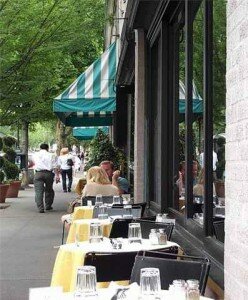
We consider the Portland “Downtown Area” as those neighborhoods where you can walk downtown within 10-15 minutes. All on the west side of the Willamette River. This includes the neighborhoods of Downtown, Northwest District (aka Nob Hill), Old Town/Chinatown, Pearl District, and Goose Hollow. The Northwest District and Goose Hollow are the only neighborhoods with detached single-family homes. The type of housing in all the other neighborhoods are apartments, condos, and row houses.
Downtown Condos
Downtown has an ever increasing number of condos with the most units in the Pearl District. Visit the Portland Business Alliance Web site for information about downtown housing. The site lists all the available condos projects for sale as well as apartments buildings that offer rentals. Here is a map of some of the apartments and condos available in the downtown area. Visit our Web page, List of Condos for a summary of all the downtown condo.
Portland Monthly Magazine Neighborhood Guide
 In their April issue every year, the Portland Monthly Magazine features the past year home prices along with other information about Portland neighborhoods and suburban communities.
The numbers on the website and the printed magazine are divided into four sections (real estate, people, crime, and lifestyle) on each of the Portland 90 plus neighborhoods as well as about 25 suburban communities. The website offers over 50 items of information about each Portland neighborhood and suburban community. There is more data online than in the printed magazine.
The magazine added a feature on their website for homes sold in 2014 and it’s also available for homes sold in 2015 — an interactive map where you can click on a neighborhood and a pop-up displays five items (1-year median price change, 5-year median price change, median gross rent, walkability score and percent of newcomer) for a Portland neighborhood as well as a suburban community.
To visit the magazine’s website latest stories and numbers visit their Real Estate section — click on “Neighborhoods” to view the numbers for the Portland neighborhoods and click on “Suburbs” for the numbers on communities in the metro area. Note the detailed numbers for each of the four sections for homes sold in 2014 and 2015 are displayed below the map. To access the Portland neighborhoods and metro communities demographic data and home prices by year:
- 2013 Demographics and Home Prices
- 2014 Demographics and Home Prices
- 2015 Demographics and Home Prices
Farmers Markets
- Downtown South Park Blocks Between Southwest Salmon and Main streets. Wednesdays from May-October. See Portland Farmers Market.
- Downtown Portland State University South Park Blocks between Southwest Harrison and Montgomery streets. Saturdays mornings to early afternoon from March-December. See Portland Farmers Market.
- Pioneer Square Downtown at Pioneer Courthouse Square. Mondays from June-October. See Portland Farmers Market.
- Northwest District/Nob Hill Between Northwest 23rd Avenue and Savier Street. Thursdays from June-September. See Portland Farmers Market.
Walking in Downtown Portland
Walk Score helps you find a walkable place to live. Walk Score is a number between 0 and 100 that measures the walkability of any address. Portland is the 12th most walkable city in the U.S. with a Walk Score of 66 and 57% of the residents have a Walk Score of 70 or above.
Neighborhoods close-in achieved some of the highest scores in the area. Walk Scores: Downtown 96, Pearl District 95, Old Town/Chinatown 94, Northwest District 92, Goose Hollow 89. Please note on the neighborhood profile pages we use an address in the center of each neighborhood to determine the Walk Score. Scores will vary in a neighborhood depending upon the address.
Here are some walking tours in the downtown area of Portland:
- Public Art Walking Tour The Regional Arts & Culture Council (RACC) along with the Portland Oregon Visitors Association have a Public Art Walking Tour map/brochure – a colorful guide to nearly 100 public art pieces in downtown Portland and the near eastside. This free brochure is available at Portland-area visitor centers, or by calling RACC at (503) 823-5111. You can also download a copy by clicking here.
- Walking Tour to Pittock Mansion This 2.8-mile walk begins in Northwest Portland and climbs some of the city’s longest staircases through Westover Heights. It ends at the Pittock Mansion, a restored French Renaissance Revival Chateau. The home, its grounds, and fabulous views are open to the public. Click here to download the guide.
- Walking Tour Nob Hill and the Pearl District This 3.3-mile walk begins at PGE Park it takes you through historic neighborhoods to shops, galleries, restaurants, and theaters in the Pearl District and Nob Hill. Click here to download the guide.
In 2009, the nonprofit Transportation for America named the Portland-Vancouver area as the ninth-safest metro area for pedestrians.
Videos
Below are some videos of places and events in the downtown area of Portland:
- Esplanade The Vera Katz Eastbank Esplanade is 1.5 miles long, extending north from the Hawthorne Bridge, past the Morrison and Burnside Bridges, to the Steel Bridge with connections to eastside neighborhoods as well as across the river to Gov. Tom McCall Waterfront Park.
- Scenes A one minute video of scenes in the downtown area. Pleasant and good background music.
- Streetcar Streetcars run on a 4.8 continuous loop from Legacy Good Samaritan Hospital at NW 23rd Avenue, on Lovejoy and Northrup, through the Pearl District and on 10th and 11th Avenues to SW 5th and Montgomery Terminus at Portland State University. Another extension (about 2 miles) goes south of downtown along the river to RiverPlace and South Waterfront.
- Burnside Skate Park Located under the east end of the Burnside Bridge, the skate park was originally built by the skating community without permission, and eventually the city approved the area as a public skatepark. The skate park was also featured in video games such as Tony Hawk’s Pro Skater, Grind Session, and Tony Hawk’s Pro Skater.
Search for Homes in Downtown Portland
![]() To search for homes in downtown Portland, go to SpatialMatch®, a real-time interactive geo-spatial search platform that delivers a totally new way to search for real estate online. Every aspect of the search process is conducted on the map, creating a fluid and entertaining user experience. You can specify the criteria and obtain all the current listings that match for Downtown Portland as well as a specific neighborhood. Available on devices configured with Adobe Flash and Java.
To search for homes in downtown Portland, go to SpatialMatch®, a real-time interactive geo-spatial search platform that delivers a totally new way to search for real estate online. Every aspect of the search process is conducted on the map, creating a fluid and entertaining user experience. You can specify the criteria and obtain all the current listings that match for Downtown Portland as well as a specific neighborhood. Available on devices configured with Adobe Flash and Java.
For mobile devices use our Quick Search that allows search by neighborhood, city, and zip code plus other perimeters.
Guide to the Neighborhoods of Goose Hollow, Northwest District, and Pearl District, and South Waterfront
Below are four neighborhoods that surround the downtown area. We have created separate web pages for each to give you details about each of them.
Inner Portland Neighborhoods
